Hoofddorp geodata
Hoofddorp (North Holland) is a populated place; located in Netherlands in Europe/Amsterdam (GMT+2) time zone. With population of 132,734 people, there are 17 cities with bigger population in this country. Compared to other cities in Netherlands, 66.5% of cities are located further ↓South; 83.3% of cities are located further →East and 98.2% of cities have higher elevation than Hoofddorp. Note1


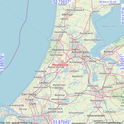
Hoofddorp GPS coordinates[2]
52° 18' 9" North, 4° 41' 20.004" East
| Map corner | latitude | longitude |
|---|---|---|
| Upper-left | 52.73037°, | 3.98576° |
| Center: | 52.3025°, | 4.68889° |
| Lower-right: | 51.87045°, | 5.39201° |
| Map W x H: | 95.6×95.6 km | = 59.4×59.4mi |
| max Lat: | 53.48025° ⇑33.5% North |
| Hoofddorp: | 52.3025° |
| min Lat: | ⇓66.5% South 50.76917° |
| min Long | Hoofddorp | max Long |
| 3.38611° | 4.68889° | 7.16528° |
| W 16.7%⇐ | ⇒83.3% E |
Elevation
Elevation of Hoofddorp is -2 m = -7 ft, and this is 17 m = 56 ft below average elevation for this country.
| Max E: |
203 m = 666 ft | 98.2% |
| Avg. | 15 m = 49 ft | |
| Hoofddorp | -2 m = -7 ft | |
Min E: |
-6 m = -20 ft | 1.8% |
See also: Hoofddorp elevation on elevation.city.
Geographical zone
Hoofddorp is located in North temperate zone (between Tropic of Cancer and the Arctic Circle). Distance of this North polar circle is 1585.7 km =985.3 mi to North.| Distance of | km | miles | from Hoofddorp |
|---|---|---|---|
| North Pole | 4191.6 | 2604.5 | to North |
| Arctic Circle | 1585.7 | 985.3 | to North |
| Tropic Cancer | 3209.6 | 1994.4 | to South |
| Equator | 5815.5 | 3613.6 | to South |


Nearby cities:
15 places around Hoofddorp: (largest is in red/bold)
• Aalsmeer
6.8 km =4.2 mi,  134°
134°
• Aalsmeerderbrug
5.2 km =3.2 mi, 127°
• Beinsdorp
6.6 km =4.1 mi,  254°
254°
• Bennebroek
6.5 km =4 mi,  288°
288°
• Cruquius
5.2 km =3.2 mi,  315°
315°
• De Glip
6.2 km =3.9 mi,  300°
300°
• Heemstede
6.9 km =4.3 mi, 319°
• Hillegom
7.3 km =4.5 mi,  259°
259°
• Kudelstaart
8.7 km =5.4 mi,  150°
150°
• Lijnden
7.2 km =4.5 mi,  39°
39°
• Oosteinde
7.7 km =4.8 mi,  109°
109°
• Vijfhuizen
5.4 km =3.4 mi,  352°
352°
• Vogelenzang
7.8 km =4.8 mi,  283°
283°
• Weerestein
6.8 km =4.2 mi,  271°
271°
• Zwaanshoek
5 km =3.1 mi, 282°
Sources, notices
• [Note1] Compared only with cities in Netherlands existing in our database
• [Src1] Map data: © OpenStreetMap contributors (CC-BY-SA)
• [Src2] Other city data from geonames.org with taken over terms of usage.
• [Src3] Geographical zone / Annual Mean Temperature by Robert A. Rohde @ Wikipedia
