Lijnden geodata
Lijnden (North Holland) is a populated place; located in Netherlands in Europe/Amsterdam (GMT+2) time zone. With population of 705 people, there are 1622 cities with bigger population in this country. Compared to other cities in Netherlands, 68.2% of cities are located further ↓South; 81.6% of cities are located further →East and 99.9% of cities have higher elevation than Lijnden. Note1


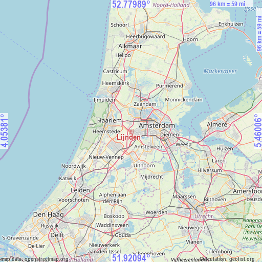
Lijnden GPS coordinates[2]
52° 21' 9" North, 4° 45' 24.984" East
| Map corner | latitude | longitude |
|---|---|---|
| Upper-left | 52.77989°, | 4.05381° |
| Center: | 52.3525°, | 4.75694° |
| Lower-right: | 51.92094°, | 5.46006° |
| Map W x H: | 95.5×95.5 km | = 59.3×59.3mi |
| max Lat: | 53.48025° ⇑31.8% North |
| Lijnden: | 52.3525° |
| min Lat: | ⇓68.2% South 50.76917° |
| min Long | Lijnden | max Long |
| 3.38611° | 4.75694° | 7.16528° |
| W 18.4%⇐ | ⇒81.6% E |
Elevation
Elevation of Lijnden is -4 m = -13 ft, and this is 19 m = 62 ft below average elevation for this country.
| Max E: |
203 m = 666 ft | 99.9% |
| Avg. | 15 m = 49 ft | |
| Lijnden | -4 m = -13 ft | |
Min E: |
-6 m = -20 ft | 0.1% |
See also: Netherlands elevation on elevation.city.
Geographical zone
Lijnden is located in North temperate zone (between Tropic of Cancer and the Arctic Circle). Distance of this North polar circle is 1580.1 km =981.8 mi to North.| Distance of | km | miles | from Lijnden |
|---|---|---|---|
| North Pole | 4186 | 2601.1 | to North |
| Arctic Circle | 1580.1 | 981.8 | to North |
| Tropic Cancer | 3215.1 | 1997.8 | to South |
| Equator | 5821.1 | 3617.1 | to South |


Nearby cities:
15 places around Lijnden: (largest is in red/bold)
• Aalsmeer
10.4 km =6.5 mi,  178°
178°
• Aalsmeerderbrug
8.7 km =5.4 mi, 183°
• Amstelveen
9.3 km =5.8 mi,  128°
128°
• Amsterdam
9.3 km =5.8 mi,  75°
75°
• Cruquius
8.5 km =5.3 mi,  257°
257°
• De Glip
10.2 km =6.3 mi, 256°
• Haarlem
8.7 km =5.4 mi,  291°
291°
• Halfweg
3.3 km =2.1 mi,  356°
356°
• Heemstede
9.1 km =5.7 mi,  268°
268°
• Hoofddorp
7.2 km =4.5 mi,  219°
219°
• Oosteinde
8.6 km =5.3 mi,  162°
162°
• Overveen
10.6 km =6.6 mi, 294°
• Vijfhuizen
5.4 km =3.4 mi, 268°
• Zaandam
10.7 km =6.6 mi,  26°
26°
• Zwaanshoek
10.5 km =6.5 mi,  244°
244°
Sources, notices
• [Note1] Compared only with cities in Netherlands existing in our database
• [Src1] Map data: © OpenStreetMap contributors (CC-BY-SA)
• [Src2] Other city data from geonames.org with taken over terms of usage.
• [Src3] Geographical zone / Annual Mean Temperature by Robert A. Rohde @ Wikipedia
