Hoenderloo geodata
Hoenderloo (Gelderland) is a populated place; located in Netherlands in Europe/Amsterdam (GMT+2) time zone. With population of 730 people, there are 1585 cities with bigger population in this country. Compared to other cities in Netherlands, 55.4% of cities are located further ↓South; 62.5% of cities are located further ←West and 93.5% of cities have lower elevation than Hoenderloo. Note1


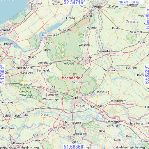
Hoenderloo GPS coordinates[2]
52° 7' 3" North, 5° 52' 45.012" East
| Map corner | latitude | longitude |
|---|---|---|
| Upper-left | 52.54716°, | 5.17604° |
| Center: | 52.1175°, | 5.87917° |
| Lower-right: | 51.68366°, | 6.58229° |
| Map W x H: | 96×96 km | = 59.7×59.7mi |
| max Lat: | 53.48025° ⇑44.6% North |
| Hoenderloo: | 52.1175° |
| min Lat: | ⇓55.4% South 50.76917° |
| min Long | Hoenderloo | max Long |
| 3.38611° | 5.87917° | 7.16528° |
| W 62.5%⇐ | ⇒37.5% E |
Elevation
Elevation of Hoenderloo is 51 m = 167 ft, and this is 36 m = 118 ft above average elevation for this country.
| Max E: |
203 m = 666 ft | 6.5% |
| Hoenderloo | 51 m 167 ft | |
| Avg. | 15 m = 49 ft | |
Min E: |
-6 m = -20 ft | 93.5% |
See also: Netherlands elevation on elevation.city.
Geographical zone
Hoenderloo is located in North temperate zone (between Tropic of Cancer and the Arctic Circle). Distance of this North polar circle is 1606.3 km =998.1 mi to North.| Distance of | km | miles | from Hoenderloo |
|---|---|---|---|
| North Pole | 4212.1 | 2617.3 | to North |
| Arctic Circle | 1606.3 | 998.1 | to North |
| Tropic Cancer | 3189 | 1981.6 | to South |
| Equator | 5794.9 | 3600.8 | to South |


Nearby cities:
15 places around Hoenderloo: (largest is in red/bold)
• Beekbergen
7.5 km =4.7 mi,  50°
50°
• Componistenkwartier
10 km =6.2 mi,  36°
36°
• De Bouwhof
8.9 km =5.5 mi,  31°
31°
• De Heeze
10.5 km =6.5 mi, 28°
• Harskamp
8.7 km =5.4 mi,  279°
279°
• Lieren
9 km =5.6 mi,  56°
56°
• Loenen
9.6 km =6 mi,  90°
90°
• Oosterhuizen
9.7 km =6 mi, 63°
• Orden
10 km =6.2 mi,  21°
21°
• Otterlo
7.6 km =4.7 mi,  255°
255°
• Rivierenkwartier
10.4 km =6.5 mi, 39°
• Ugchelen
8.3 km =5.2 mi, 25°
• Vogelkwartier
10.8 km =6.7 mi, 33°
• Westenenk
10.2 km =6.3 mi, 31°
• Winkewijert
9.8 km =6.1 mi, 33°
Sources, notices
• [Note1] Compared only with cities in Netherlands existing in our database
• [Src1] Map data: © OpenStreetMap contributors (CC-BY-SA)
• [Src2] Other city data from geonames.org with taken over terms of usage.
• [Src3] Geographical zone / Annual Mean Temperature by Robert A. Rohde @ Wikipedia
