Broekdijk geodata
Broekdijk (Gelderland) is a populated place; located in Netherlands in Europe/Amsterdam (GMT+2) time zone. With population of 825 people, there are 1509 cities with bigger population in this country. Compared to other cities in Netherlands, 70.2% of cities are located further ↓South; 66.5% of cities are located further ←West and 58.8% of cities have higher elevation than Broekdijk. Note1


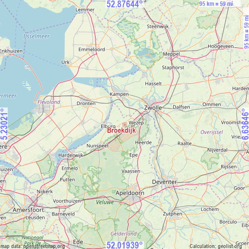
Broekdijk GPS coordinates[2]
52° 27' 0" North, 5° 55' 59.988" East
| Map corner | latitude | longitude |
|---|---|---|
| Upper-left | 52.87644°, | 5.23021° |
| Center: | 52.45°, | 5.93333° |
| Lower-right: | 52.01939°, | 6.63646° |
| Map W x H: | 95.3×95.3 km | = 59.2×59.2mi |
| max Lat: | 53.48025° ⇑29.8% North |
| Broekdijk: | 52.45° |
| min Lat: | ⇓70.2% South 50.76917° |
| min Long | Broekdijk | max Long |
| 3.38611° | 5.93333° | 7.16528° |
| W 66.5%⇐ | ⇒33.5% E |
Elevation
Elevation of Broekdijk is 4 m = 13 ft, and this is 11 m = 36 ft below average elevation for this country.
| Max E: |
203 m = 666 ft | 58.8% |
| Avg. | 15 m = 49 ft | |
| Broekdijk | 4 m = 13 ft | |
Min E: |
-6 m = -20 ft | 41.2% |
See also: Netherlands elevation on elevation.city.
Geographical zone
Broekdijk is located in North temperate zone (between Tropic of Cancer and the Arctic Circle). Distance of this North polar circle is 1569.3 km =975.1 mi to North.| Distance of | km | miles | from Broekdijk |
|---|---|---|---|
| North Pole | 4175.2 | 2594.3 | to North |
| Arctic Circle | 1569.3 | 975.1 | to North |
| Tropic Cancer | 3226 | 2004.5 | to South |
| Equator | 5831.9 | 3623.8 | to South |


Nearby cities:
15 places around Broekdijk: (largest is in red/bold)
• Doornspijk
8.6 km =5.3 mi,  245°
245°
• Elburg
6.1 km =3.8 mi,  267°
267°
• Epe
11.9 km =7.4 mi,  163°
163°
• Flevowijk
10.7 km =6.6 mi,  352°
352°
• Hattem
9.3 km =5.8 mi,  72°
72°
• Hattemerbroek
6.6 km =4.1 mi, 65°
• Heerde
10.1 km =6.3 mi,  133°
133°
• Hoge Enk
6.6 km =4.1 mi, 250°
• Kampen
11.8 km =7.3 mi, 352°
• Kamperveen
6.4 km =4 mi,  358°
358°
• Oldebroek
2.2 km =1.4 mi,  255°
255°
• Oostendorp
5.4 km =3.4 mi, 266°
• Oosterwolde
3.3 km =2.1 mi,  301°
301°
• Wapenveld
9.8 km =6.1 mi,  103°
103°
• Wilsum
9 km =5.6 mi,  14°
14°
Sources, notices
• [Note1] Compared only with cities in Netherlands existing in our database
• [Src1] Map data: © OpenStreetMap contributors (CC-BY-SA)
• [Src2] Other city data from geonames.org with taken over terms of usage.
• [Src3] Geographical zone / Annual Mean Temperature by Robert A. Rohde @ Wikipedia
