Oldebroek geodata
Oldebroek (Gelderland) is a populated place; located in Netherlands in Europe/Amsterdam (GMT+2) time zone. With population of 3,275 people, there are 718 cities with bigger population in this country. Compared to other cities in Netherlands, 70% of cities are located further ↓South; 64.7% of cities are located further ←West and 65.8% of cities have higher elevation than Oldebroek. Note1


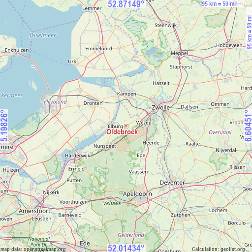
Oldebroek GPS coordinates[2]
52° 26' 42" North, 5° 54' 5.004" East
| Map corner | latitude | longitude |
|---|---|---|
| Upper-left | 52.87149°, | 5.19826° |
| Center: | 52.445°, | 5.90139° |
| Lower-right: | 52.01434°, | 6.60451° |
| Map W x H: | 95.3×95.3 km | = 59.2×59.2mi |
| max Lat: | 53.48025° ⇑30% North |
| Oldebroek: | 52.445° |
| min Lat: | ⇓70% South 50.76917° |
| min Long | Oldebroek | max Long |
| 3.38611° | 5.90139° | 7.16528° |
| W 64.7%⇐ | ⇒35.3% E |
Elevation
Elevation of Oldebroek is 3 m = 10 ft, and this is 12 m = 39 ft below average elevation for this country.
| Max E: |
203 m = 666 ft | 65.8% |
| Avg. | 15 m = 49 ft | |
| Oldebroek | 3 m = 10 ft | |
Min E: |
-6 m = -20 ft | 34.2% |
See also: Netherlands elevation on elevation.city.
Geographical zone
Oldebroek is located in North temperate zone (between Tropic of Cancer and the Arctic Circle). Distance of this North polar circle is 1569.8 km =975.4 mi to North.| Distance of | km | miles | from Oldebroek |
|---|---|---|---|
| North Pole | 4175.7 | 2594.7 | to North |
| Arctic Circle | 1569.8 | 975.4 | to North |
| Tropic Cancer | 3225.4 | 2004.2 | to South |
| Equator | 5831.3 | 3623.4 | to South |


Nearby cities:
15 places around Oldebroek: (largest is in red/bold)
• Broekdijk
2.2 km =1.4 mi,  75°
75°
• Doornspijk
6.4 km =4 mi,  242°
242°
• Elburg
4 km =2.5 mi,  274°
274°
• Flevowijk
11.2 km =7 mi,  4°
4°
• Hattem
11.5 km =7.1 mi,  73°
73°
• Hattemerbroek
8.8 km =5.5 mi, 68°
• Heerde
11.4 km =7.1 mi,  124°
124°
• Hoge Enk
4.4 km =2.7 mi,  247°
247°
• Kampen
12.2 km =7.6 mi, 3°
• Kamperveen
7.3 km =4.5 mi,  15°
15°
• Nunspeet
10.7 km =6.6 mi,  226°
226°
• Oostendorp
3.2 km =2 mi, 274°
• Oosterwolde
2.4 km =1.5 mi,  344°
344°
• Wapenveld
11.8 km =7.3 mi,  98°
98°
• Wilsum
10.3 km =6.4 mi,  25°
25°
Sources, notices
• [Note1] Compared only with cities in Netherlands existing in our database
• [Src1] Map data: © OpenStreetMap contributors (CC-BY-SA)
• [Src2] Other city data from geonames.org with taken over terms of usage.
• [Src3] Geographical zone / Annual Mean Temperature by Robert A. Rohde @ Wikipedia
