Harstad geodata
Harstad (Troms) is a seat of a second-order administrative division; located in Norway in Europe/Oslo (GMT+2) time zone. With population of 19,433 people, there are 25 cities with bigger population in this country. Compared to other cities in Norway, 93.2% of cities are located further ↓South; 92.1% of cities are located further ←West and 100% of cities have higher elevation than Harstad. Note1


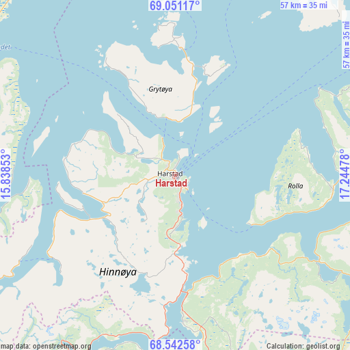
Harstad GPS coordinates[2]
68° 47' 53.988" North, 16° 32' 29.94" East
| Map corner | latitude | longitude |
|---|---|---|
| Upper-left | 69.05117°, | 15.83853° |
| Center: | 68.79833°, | 16.54165° |
| Lower-right: | 68.54258°, | 17.24478° |
| Map W x H: | 56.5×56.5 km | = 35.1×35.1mi |
| max Lat: | 71.04137° ⇑6.8% North |
| Harstad: | 68.79833° |
| min Lat: | ⇓93.2% South 58.0274° |
| min Long | Harstad | max Long |
| 4.71485° | 16.54165° | 31.11066° |
| W 92.1%⇐ | ⇒7.9% E |
Elevation
Elevation of Harstad is 1 m = 3 ft, and this is 103.2 m = 339 ft below average elevation for this country.
| Max E: |
897 m = 2943 ft | 100% |
| Avg. | 104.2 m = 342 ft | |
| Harstad | 1 m = 3 ft | |
Min E: |
1 m = 3 ft | 0% |
See also: Norway elevation on elevation.city.
Geographical zone
Harstad is located in North Frigid zone (between North Pole and Arctic Circle). Distance of this North polar circle is 248.5 km =154.4 mi to South.| Distance of | km | miles | from Harstad |
|---|---|---|---|
| North Pole | 2357.4 | 1464.8 | to North |
| Arctic Circle | 248.5 | 154.4 | to South |
| Tropic Cancer | 5043.7 | 3134 | to South |
| Equator | 7649.7 | 4753.3 | to South |


Nearby cities:
15 places around Harstad: (largest is in red/bold)
• Ballangen
52 km =32.3 mi,  166°
166°
• Bjerkvik
49.5 km =30.8 mi,  124°
124°
• Bogen
35.3 km =21.9 mi,  148°
148°
• Borkenes
15.2 km =9.4 mi,  259°
259°
• Evenskjer
24 km =14.9 mi,  177°
177°
• Gratangen
48.9 km =30.4 mi,  109°
109°
• Hamnvik
25.4 km =15.8 mi,  94°
94°
• Hol
28.4 km =17.6 mi,  192°
192°
• Lødingen
48.1 km =29.9 mi,  207°
207°
• Myre
41.3 km =25.7 mi,  325°
325°
• Sigerfjord
45 km =28 mi,  247°
247°
• Sjøvegan
53.1 km =33 mi,  80°
80°
• Sortland
47.2 km =29.3 mi, 256°
• Strand
45.4 km =28.2 mi, 255°
• Tennevoll
51.2 km =31.8 mi,  96°
96°
Sources, notices
• [Note1] Compared only with cities in Norway existing in our database
• [Src1] Map data: © OpenStreetMap contributors (CC-BY-SA)
• [Src2] Other city data from geonames.org with taken over terms of usage.
• [Src3] Geographical zone / Annual Mean Temperature by Robert A. Rohde @ Wikipedia
