Fedje geodata
Fedje (Hordaland) is a seat of a second-order administrative division; located in Norway in Europe/Oslo (GMT+2) time zone. With population of 480 people, there are 461 cities with bigger population in this country. Compared to other cities in Norway, 52.5% of cities are located further ↓South; 100% of cities are located further →East and 92.1% of cities have higher elevation than Fedje. Note1


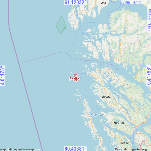
Fedje GPS coordinates[2]
60° 46' 44.04" North, 4° 42' 53.46" East
| Map corner | latitude | longitude |
|---|---|---|
| Upper-left | 61.12032°, | 4.01173° |
| Center: | 60.7789°, | 4.71485° |
| Lower-right: | 60.43381°, | 5.41798° |
| Map W x H: | 76.3×76.3 km | = 47.4×47.4mi |
| max Lat: | 71.04137° ⇑47.5% North |
| Fedje: | 60.7789° |
| min Lat: | ⇓52.5% South 58.0274° |
| min Long | Fedje | max Long |
| 4.71485° | 4.71485° | 31.11066° |
| W 0%⇐ | ⇒100% E |
Elevation
Elevation of Fedje is 3 m = 10 ft, and this is 101.2 m = 332 ft below average elevation for this country.
| Max E: |
897 m = 2943 ft | 92.1% |
| Avg. | 104.2 m = 342 ft | |
| Fedje | 3 m = 10 ft | |
Min E: |
1 m = 3 ft | 7.9% |
See also: Norway elevation on elevation.city.
Geographical zone
Fedje is located in North temperate zone (between Tropic of Cancer and the Arctic Circle). Distance of this North polar circle is 643.2 km =399.7 mi to North.| Distance of | km | miles | from Fedje |
|---|---|---|---|
| North Pole | 3249.1 | 2018.9 | to North |
| Arctic Circle | 643.2 | 399.7 | to North |
| Tropic Cancer | 4152.1 | 2580 | to South |
| Equator | 6758 | 4199.2 | to South |


Nearby cities:
15 places around Fedje: (largest is in red/bold)
• Austrheim
11.8 km =7.3 mi,  90°
90°
• Eivindvik
29.8 km =18.5 mi,  40°
40°
• Frekhaug
41.2 km =25.6 mi,  135°
135°
• Hardbakke
33.7 km =20.9 mi,  11°
11°
• Hylkje
45.9 km =28.5 mi,  130°
130°
• Isdalstø
39.1 km =24.3 mi, 129°
• Knappskog
48.2 km =30 mi,  157°
157°
• Knarvik
40.4 km =25.1 mi, 130°
• Lindås
24.7 km =15.3 mi,  101°
101°
• Manger
23.4 km =14.5 mi, 130°
• Masfjorden
32.1 km =19.9 mi, 86°
• Sollsvika
40.5 km =25.2 mi, 160°
• Tjeldstø
21.5 km =13.4 mi, 160°
• Ågotnes
45 km =28 mi, 158°
• Årås
11.8 km =7.3 mi, 90°
Sources, notices
• [Note1] Compared only with cities in Norway existing in our database
• [Src1] Map data: © OpenStreetMap contributors (CC-BY-SA)
• [Src2] Other city data from geonames.org with taken over terms of usage.
• [Src3] Geographical zone / Annual Mean Temperature by Robert A. Rohde @ Wikipedia
