Aukra geodata
Aukra (Møre og Romsdal) is a populated place; located in Norway in Europe/Oslo (GMT+2) time zone. With population of 730 people, there are 373 cities with bigger population in this country. Compared to other cities in Norway, 71% of cities are located further ↓South; 74.4% of cities are located further →East and 61.1% of cities have higher elevation than Aukra. Note1


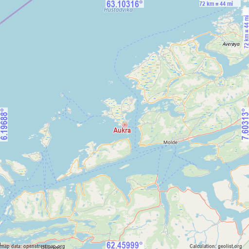
Aukra GPS coordinates[2]
62° 46' 59.988" North, 6° 54' 0" East
| Map corner | latitude | longitude |
|---|---|---|
| Upper-left | 63.10316°, | 6.19688° |
| Center: | 62.78333°, | 6.9° |
| Lower-right: | 62.45999°, | 7.60313° |
| Map W x H: | 71.5×71.5 km | = 44.4×44.4mi |
| max Lat: | 71.04137° ⇑29% North |
| Aukra: | 62.78333° |
| min Lat: | ⇓71% South 58.0274° |
| min Long | Aukra | max Long |
| 4.71485° | 6.9° | 31.11066° |
| W 25.6%⇐ | ⇒74.4% E |
Elevation
Elevation of Aukra is 26 m = 85 ft, and this is 78.2 m = 257 ft below average elevation for this country.
| Max E: |
897 m = 2943 ft | 61.1% |
| Avg. | 104.2 m = 342 ft | |
| Aukra | 26 m = 85 ft | |
Min E: |
1 m = 3 ft | 38.9% |
See also: Norway elevation on elevation.city.
Geographical zone
Aukra is located in North temperate zone (between Tropic of Cancer and the Arctic Circle). Distance of this North polar circle is 420.3 km =261.2 mi to North.| Distance of | km | miles | from Aukra |
|---|---|---|---|
| North Pole | 3026.2 | 1880.4 | to North |
| Arctic Circle | 420.3 | 261.2 | to North |
| Tropic Cancer | 4374.9 | 2718.4 | to South |
| Equator | 6980.9 | 4337.7 | to South |


Nearby cities:
15 places around Aukra: (largest is in red/bold)
• Brattvåg
30.9 km =19.2 mi,  228°
228°
• Bud
13.8 km =8.6 mi,  2°
2°
• Eide
31.5 km =19.6 mi,  61°
61°
• Elnesvågen
14.4 km =8.9 mi, 56°
• Falkhytta
2.5 km =1.6 mi,  344°
344°
• Giskemo
33.4 km =20.8 mi,  182°
182°
• Hjelset
30.1 km =18.7 mi,  90°
90°
• Midsund
16.8 km =10.4 mi,  223°
223°
• Molde
14.1 km =8.8 mi,  111°
111°
• Sjøholt
33.7 km =20.9 mi,  187°
187°
• Skodje
32.7 km =20.3 mi,  198°
198°
• Steinshamn
21.8 km =13.5 mi,  270°
270°
• Tomra
22.5 km =14 mi, 175°
• Vatne
28.9 km =18 mi,  209°
209°
• Vestnes
20 km =12.4 mi,  151°
151°
Sources, notices
• [Note1] Compared only with cities in Norway existing in our database
• [Src1] Map data: © OpenStreetMap contributors (CC-BY-SA)
• [Src2] Other city data from geonames.org with taken over terms of usage.
• [Src3] Geographical zone / Annual Mean Temperature by Robert A. Rohde @ Wikipedia
