Paengaroa geodata
Paengaroa (Bay of Plenty) is a populated place; located in New Zealand in Pacific/Auckland (GMT+12) time zone. With population of 901 people, there are 146 cities with bigger population in this country. Compared to other cities in New Zealand, 68.6% of cities are located further ↓South; 90.8% of cities are located further ←West and 56% of cities have higher elevation than Paengaroa. Note1


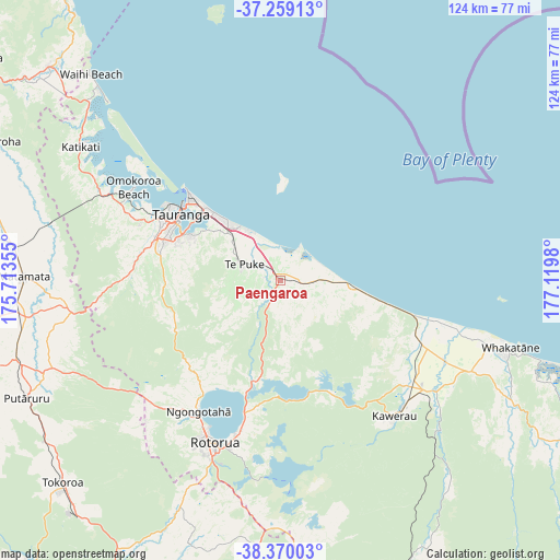
Paengaroa GPS coordinates[2]
37° 49' 0.012" South, 176° 25' 0.012" East
| Map corner | latitude | longitude |
|---|---|---|
| Upper-left | -37.25913°, | 175.71355° |
| Center: | -37.81667°, | 176.41667° |
| Lower-right: | -38.37003°, | 177.1198° |
| Map W x H: | 123.5×123.5 km | = 76.7×76.7mi |
| max Lat: | -34.99604° ⇑31.4% North |
| Paengaroa: | -37.81667° |
| min Lat: | ⇓68.6% South -46.6° |
| min Long | Paengaroa | max Long |
| -176.55973° | 176.41667° | 178.33333° |
| W 90.8%⇐ | ⇒9.2% E |
Elevation
Elevation of Paengaroa is 27 m = 89 ft, and this is 57.4 m = 188 ft below average elevation for this country.
| Max E: |
819 m = 2687 ft | 56% |
| Avg. | 84.4 m = 277 ft | |
| Paengaroa | 27 m = 89 ft | |
Min E: |
3 m = 10 ft | 44% |
See also: New Zealand elevation on elevation.city.
Geographical zone
Paengaroa is located in South temperate zone (between Tropic of Capricorn and the Antarctic Circle). Distance of this Southern Tropic circle is 1598.9 km =993.5 mi to North.| Distance of | km | miles | from Paengaroa |
|---|---|---|---|
| Equator | 4204.8 | 2612.7 | to North |
| Tropic Capricorn | 1598.9 | 993.5 | to North |
| Antarctic Circle | 3196.4 | 1986.2 | to South |
| South Pole | 5802.2 | 3605.3 | to South |


Nearby cities:
15 places around Paengaroa: (largest is in red/bold)
• Athenree
58.8 km =36.5 mi,  311°
311°
• Edgecumbe
41 km =25.5 mi,  116°
116°
• Katikati
53.1 km =33 mi,  303°
303°
• Kawerau
40.1 km =24.9 mi,  141°
141°
• Maketu
6.3 km =3.9 mi,  27°
27°
• Mamaku
43 km =26.7 mi,  222°
222°
• Matamata
57.5 km =35.7 mi,  270°
270°
• Matata
30.2 km =18.8 mi,  104°
104°
• Rotorua
38.8 km =24.1 mi,  202°
202°
• Taneatua
59.5 km =37 mi, 117°
• Tauranga
26.3 km =16.3 mi, 303°
• Tirau
61.4 km =38.2 mi,  252°
252°
• Waharoa
57.4 km =35.7 mi,  275°
275°
• Waihi Beach
62.9 km =39.1 mi,  317°
317°
• Whakatane
52.3 km =32.5 mi,  107°
107°
Sources, notices
• [Note1] Compared only with cities in New Zealand existing in our database
• [Src1] Map data: © OpenStreetMap contributors (CC-BY-SA)
• [Src2] Other city data from geonames.org with taken over terms of usage.
• [Src3] Geographical zone / Annual Mean Temperature by Robert A. Rohde @ Wikipedia
