Tubualá geodata
Tubualá (Guna Yala) is a populated place; located in Panama in America/Panama (GMT-5) time zone. With population of 1,061 people, there are 237 cities with bigger population in this country. Compared to other cities in Panama, 98.2% of cities are located further ↓South; 91.8% of cities are located further ←West and 99.4% of cities have higher elevation than Tubualá. Note1


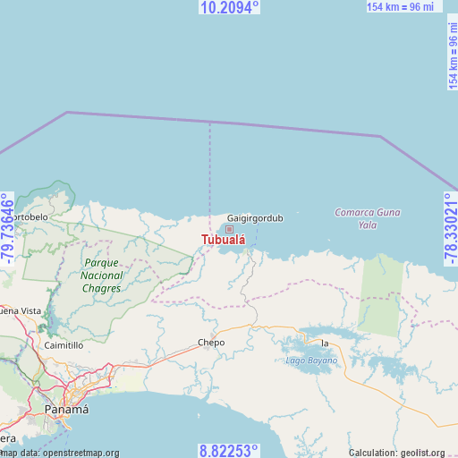
Tubualá GPS coordinates[2]
9° 31' 0.012" North, 79° 1' 59.988" West
| Map corner | latitude | longitude |
|---|---|---|
| Upper-left | 10.2094°, | -79.73646° |
| Center: | 9.51667°, | -79.03333° |
| Lower-right: | 8.82253°, | -78.33021° |
| Map W x H: | 154.2×154.2 km | = 95.8×95.8mi |
| max Lat: | 9.60898° ⇑1.8% North |
| Tubualá: | 9.51667° |
| min Lat: | ⇓98.2% South 7.26534° |
| min Long | Tubualá | max Long |
| -82.91275° | -79.03333° | -77.38965° |
| W 91.8%⇐ | ⇒8.2% E |
Elevation
Elevation of Tubualá is 3 m = 10 ft, and this is 169.1 m = 555 ft below average elevation for this country.
| Max E: |
2103 m = 6900 ft | 99.4% |
| Avg. | 172.1 m = 565 ft | |
| Tubualá | 3 m = 10 ft | |
Min E: |
-1 m = -3 ft | 0.6% |
See also: Panama elevation on elevation.city.
Geographical zone
Tubualá is located in North Torrid zone (between Equator and Tropic of Cancer). Distance of Equator is 1058.2 km =657.5 mi to South.| Distance of | km | miles | from Tubualá |
|---|---|---|---|
| North Pole | 8948.9 | 5560.6 | to North |
| Arctic Circle | 6343 | 3941.4 | to North |
| Tropic Cancer | 1547.8 | 961.8 | to North |
| Equator | 1058.2 | 657.5 | to South |


Nearby cities:
15 places around Tubualá: (largest is in red/bold)
• Cartí Sugdup
10 km =6.2 mi,  125°
125°
• Cañita
36.1 km =22.4 mi,  155°
155°
• Chepo
39.2 km =24.4 mi,  190°
190°
• Cuango
31.6 km =19.6 mi,  280°
280°
• El Porvenir
9.7 km =6 mi,  65°
65°
• El Progreso
29.3 km =18.2 mi,  198°
198°
• Las Margaritas
37.4 km =23.2 mi, 189°
• Miramar
33.8 km =21 mi, 281°
• Palenque
36.7 km =22.8 mi, 279°
• Palmira
20.6 km =12.8 mi, 278°
• Playa Chiquita
28.9 km =18 mi, 280°
• San Miguel
41.4 km =25.7 mi,  216°
216°
• Santa Isabel
18 km =11.2 mi, 278°
• Unión de Azuero
43.2 km =26.8 mi, 200°
• Viento Frío
41.6 km =25.8 mi, 280°
Sources, notices
• [Note1] Compared only with cities in Panama existing in our database
• [Src1] Map data: © OpenStreetMap contributors (CC-BY-SA)
• [Src2] Other city data from geonames.org with taken over terms of usage.
• [Src3] Geographical zone / Annual Mean Temperature by Robert A. Rohde @ Wikipedia
