Cartí Sugdup geodata
Cartí Sugdup (Guna Yala) is a populated place; located in Panama in America/Panama (GMT-5) time zone. With population of 1,050 people, there are 243 cities with bigger population in this country. Compared to other cities in Panama, 97.9% of cities are located further ↓South; 91.9% of cities are located further ←West and 99.4% of cities have higher elevation than Cartí Sugdup. Note1


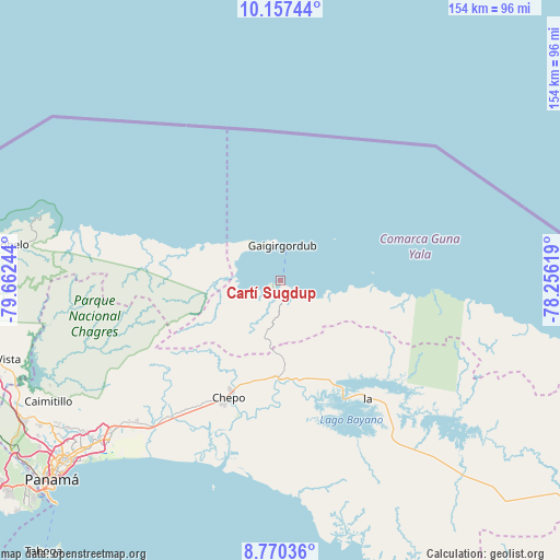
Cartí Sugdup GPS coordinates[2]
9° 27' 52.56" North, 78° 57' 33.516" West
| Map corner | latitude | longitude |
|---|---|---|
| Upper-left | 10.15744°, | -79.66244° |
| Center: | 9.4646°, | -78.95931° |
| Lower-right: | 8.77036°, | -78.25619° |
| Map W x H: | 154.2×154.2 km | = 95.8×95.8mi |
| max Lat: | 9.60898° ⇑2.1% North |
| Cartí Sugdup: | 9.4646° |
| min Lat: | ⇓97.9% South 7.26534° |
| min Long | Cartí Sugdup | max Long |
| -82.91275° | -78.95931° | -77.38965° |
| W 91.9%⇐ | ⇒8.1% E |
Elevation
Elevation of Cartí Sugdup is 3 m = 10 ft, and this is 169.1 m = 555 ft below average elevation for this country.
| Max E: |
2103 m = 6900 ft | 99.4% |
| Avg. | 172.1 m = 565 ft | |
| Cartí Sugdup | 3 m = 10 ft | |
Min E: |
-1 m = -3 ft | 0.6% |
See also: Panama elevation on elevation.city.
Geographical zone
Cartí Sugdup is located in North Torrid zone (between Equator and Tropic of Cancer). Distance of Equator is 1052.4 km =653.9 mi to South.| Distance of | km | miles | from Cartí Sugdup |
|---|---|---|---|
| North Pole | 8954.7 | 5564.2 | to North |
| Arctic Circle | 6348.8 | 3945 | to North |
| Tropic Cancer | 1553.6 | 965.4 | to North |
| Equator | 1052.4 | 653.9 | to South |


Nearby cities:
15 places around Cartí Sugdup: (largest is in red/bold)
• Cañita
27.8 km =17.3 mi,  165°
165°
• Chepo
36.2 km =22.5 mi,  205°
205°
• Cuango
40.8 km =25.4 mi,  286°
286°
• El Porvenir
9.8 km =6.1 mi,  4°
4°
• El Progreso
28 km =17.4 mi,  218°
218°
• Icantí
41.1 km =25.5 mi,  132°
132°
• Las Margaritas
34.2 km =21.3 mi,  204°
204°
• Miramar
43.1 km =26.8 mi, 286°
• Narganá
40.9 km =25.4 mi,  93°
93°
• Palmira
29.9 km =18.6 mi, 287°
• Playa Chiquita
38.2 km =23.7 mi, 287°
• San Miguel
42.7 km =26.5 mi,  229°
229°
• Santa Isabel
27.2 km =16.9 mi, 287°
• Tubualá
10 km =6.2 mi,  305°
305°
• Unión de Azuero
41.7 km =25.9 mi, 213°
Sources, notices
• [Note1] Compared only with cities in Panama existing in our database
• [Src1] Map data: © OpenStreetMap contributors (CC-BY-SA)
• [Src2] Other city data from geonames.org with taken over terms of usage.
• [Src3] Geographical zone / Annual Mean Temperature by Robert A. Rohde @ Wikipedia
