Rodeo Viejo geodata
Rodeo Viejo (Veraguas) is a seat of a third-order administrative division; located in Panama in America/Panama (GMT-5) time zone. With population of 140 people, there are 637 cities with bigger population in this country. Compared to other cities in Panama, 76.2% of cities are located further ↑North; 67% of cities are located further →East and 51.9% of cities have lower elevation than Rodeo Viejo. Note1


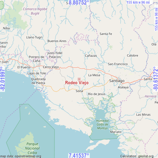
Rodeo Viejo GPS coordinates[2]
8° 6' 43.38" North, 81° 19' 0.624" West
| Map corner | latitude | longitude |
|---|---|---|
| Upper-left | 8.80752°, | -82.01997° |
| Center: | 8.11205°, | -81.31684° |
| Lower-right: | 7.41537°, | -80.61372° |
| Map W x H: | 154.8×154.8 km | = 96.2×96.2mi |
| max Lat: | 9.60898° ⇑76.2% North |
| Rodeo Viejo: | 8.11205° |
| min Lat: | ⇓23.8% South 7.26534° |
| min Long | Rodeo Viejo | max Long |
| -82.91275° | -81.31684° | -77.38965° |
| W 33%⇐ | ⇒67% E |
Elevation
Elevation of Rodeo Viejo is 77 m = 253 ft, and this is 95.1 m = 312 ft below average elevation for this country.
| Max E: |
2103 m = 6900 ft | 48.1% |
| Avg. | 172.1 m = 565 ft | |
| Rodeo Viejo | 77 m = 253 ft | |
Min E: |
-1 m = -3 ft | 51.9% |
See also: Panama elevation on elevation.city.
Geographical zone
Rodeo Viejo is located in North Torrid zone (between Equator and Tropic of Cancer). Distance of Equator is 902 km =560.5 mi to South.| Distance of | km | miles | from Rodeo Viejo |
|---|---|---|---|
| North Pole | 9105.1 | 5657.6 | to North |
| Arctic Circle | 6499.2 | 4038.4 | to North |
| Tropic Cancer | 1703.9 | 1058.8 | to North |
| Equator | 902 | 560.5 | to South |


Nearby cities:
15 places around Rodeo Viejo: (largest is in red/bold)
• Bisvalles
13.2 km =8.2 mi,  53°
53°
• Boró
6.6 km =4.1 mi,  15°
15°
• Corozal
14.1 km =8.8 mi,  254°
254°
• El Marañón
14.1 km =8.8 mi,  127°
127°
• El María
16.8 km =10.4 mi,  236°
236°
• El Rincón
15.1 km =9.4 mi,  302°
302°
• La Mesa
15.4 km =9.6 mi,  75°
75°
• La Tollosa
13.7 km =8.5 mi,  183°
183°
• Las Palmas
15.6 km =9.7 mi,  279°
279°
• Lolá
17.2 km =10.7 mi,  263°
263°
• Quebrada de Oro
11.5 km =7.1 mi,  222°
222°
• San Bartolo
11.9 km =7.4 mi, 22°
• San Francisco
7.5 km =4.7 mi,  227°
227°
• Soná
11.1 km =6.9 mi, 182°
• Tríbique
13 km =8.1 mi, 179°
Sources, notices
• [Note1] Compared only with cities in Panama existing in our database
• [Src1] Map data: © OpenStreetMap contributors (CC-BY-SA)
• [Src2] Other city data from geonames.org with taken over terms of usage.
• [Src3] Geographical zone / Annual Mean Temperature by Robert A. Rohde @ Wikipedia
