Rincón Largo geodata
Rincón Largo (Veraguas) is a populated place; located in Panama in America/Panama (GMT-5) time zone. With population of 767 people, there are 335 cities with bigger population in this country. Compared to other cities in Panama, 84.5% of cities are located further ↑North; 62.8% of cities are located further →East and 68.9% of cities have higher elevation than Rincón Largo. Note1


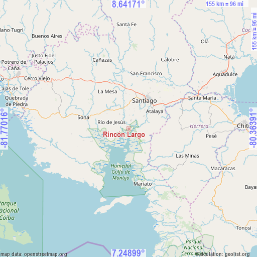
Rincón Largo GPS coordinates[2]
7° 56' 45.384" North, 81° 4' 1.308" West
| Map corner | latitude | longitude |
|---|---|---|
| Upper-left | 8.64171°, | -81.77016° |
| Center: | 7.94594°, | -81.06703° |
| Lower-right: | 7.24899°, | -80.36391° |
| Map W x H: | 154.9×154.9 km | = 96.3×96.3mi |
| max Lat: | 9.60898° ⇑84.5% North |
| Rincón Largo: | 7.94594° |
| min Lat: | ⇓15.5% South 7.26534° |
| min Long | Rincón Largo | max Long |
| -82.91275° | -81.06703° | -77.38965° |
| W 37.2%⇐ | ⇒62.8% E |
Elevation
Elevation of Rincón Largo is 37 m = 121 ft, and this is 135.1 m = 443 ft below average elevation for this country.
| Max E: |
2103 m = 6900 ft | 68.9% |
| Avg. | 172.1 m = 565 ft | |
| Rincón Largo | 37 m = 121 ft | |
Min E: |
-1 m = -3 ft | 31.1% |
See also: Panama elevation on elevation.city.
Geographical zone
Rincón Largo is located in North Torrid zone (between Equator and Tropic of Cancer). Distance of Equator is 883.5 km =549 mi to South.| Distance of | km | miles | from Rincón Largo |
|---|---|---|---|
| North Pole | 9123.6 | 5669.1 | to North |
| Arctic Circle | 6517.7 | 4049.9 | to North |
| Tropic Cancer | 1722.4 | 1070.2 | to North |
| Equator | 883.5 | 549 | to South |


Nearby cities:
15 places around Rincón Largo: (largest is in red/bold)
• Atalaya
18.9 km =11.7 mi,  55°
55°
• El Barrito
13.2 km =8.2 mi,  82°
82°
• El Bongo
2.1 km =1.3 mi, 81°
• El Pilón
1.4 km =0.9 mi,  311°
311°
• El Pájaro
6.1 km =3.8 mi,  277°
277°
• La Colorada
11.6 km =7.2 mi,  50°
50°
• La Garceana
5.7 km =3.5 mi,  100°
100°
• Las Huacas
9.5 km =5.9 mi,  238°
238°
• Llano Grande
16.2 km =10.1 mi,  331°
331°
• Los Algarrobos
19.1 km =11.9 mi,  17°
17°
• Los Castillos
10.4 km =6.5 mi, 326°
• Montijo
4.9 km =3 mi,  13°
13°
• Ponuga
12 km =7.5 mi,  125°
125°
• Río de Jesús
11 km =6.8 mi,  289°
289°
• Utirá
16.9 km =10.5 mi, 279°
Sources, notices
• [Note1] Compared only with cities in Panama existing in our database
• [Src1] Map data: © OpenStreetMap contributors (CC-BY-SA)
• [Src2] Other city data from geonames.org with taken over terms of usage.
• [Src3] Geographical zone / Annual Mean Temperature by Robert A. Rohde @ Wikipedia
