Llano Grande geodata
Llano Grande (Veraguas) is a seat of a third-order administrative division; located in Panama in America/Panama (GMT-5) time zone. With population of 328 people, there are 548 cities with bigger population in this country. Compared to other cities in Panama, 78.2% of cities are located further ↑North; 64.1% of cities are located further →East and 63.2% of cities have higher elevation than Llano Grande. Note1


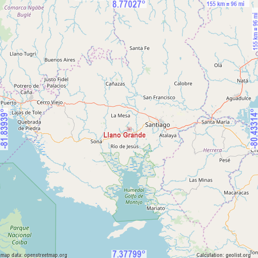
Llano Grande GPS coordinates[2]
8° 4' 29.028" North, 81° 8' 10.536" West
| Map corner | latitude | longitude |
|---|---|---|
| Upper-left | 8.77027°, | -81.83939° |
| Center: | 8.07473°, | -81.13626° |
| Lower-right: | 7.37799°, | -80.43314° |
| Map W x H: | 154.8×154.8 km | = 96.2×96.2mi |
| max Lat: | 9.60898° ⇑78.2% North |
| Llano Grande: | 8.07473° |
| min Lat: | ⇓21.8% South 7.26534° |
| min Long | Llano Grande | max Long |
| -82.91275° | -81.13626° | -77.38965° |
| W 35.9%⇐ | ⇒64.1% E |
Elevation
Elevation of Llano Grande is 48 m = 157 ft, and this is 124.1 m = 407 ft below average elevation for this country.
| Max E: |
2103 m = 6900 ft | 63.2% |
| Avg. | 172.1 m = 565 ft | |
| Llano Grande | 48 m = 157 ft | |
Min E: |
-1 m = -3 ft | 36.8% |
See also: Panama elevation on elevation.city.
Geographical zone
Llano Grande is located in North Torrid zone (between Equator and Tropic of Cancer). Distance of Equator is 897.8 km =557.9 mi to South.| Distance of | km | miles | from Llano Grande |
|---|---|---|---|
| North Pole | 9109.2 | 5660.2 | to North |
| Arctic Circle | 6503.3 | 4041 | to North |
| Tropic Cancer | 1708.1 | 1061.4 | to North |
| Equator | 897.8 | 557.9 | to South |


Nearby cities:
15 places around Llano Grande: (largest is in red/bold)
• Bisvalles
15.2 km =9.4 mi,  322°
322°
• El Marañón
9.7 km =6 mi,  243°
243°
• El Pilón
14.9 km =9.3 mi,  153°
153°
• El Pájaro
13.6 km =8.5 mi,  173°
173°
• La Mesa
9.4 km =5.8 mi,  328°
328°
• La Peña
13.4 km =8.3 mi,  63°
63°
• Las Barreras
15.6 km =9.7 mi,  77°
77°
• Los Algarrobos
14 km =8.7 mi,  74°
74°
• Los Castillos
6 km =3.7 mi,  162°
162°
• Los Remedios
14.3 km =8.9 mi, 59°
• Montijo
13 km =8.1 mi,  137°
137°
• Rincón Largo
16.2 km =10.1 mi, 151°
• Río de Jesús
11 km =6.8 mi,  194°
194°
• San Pedro del Espino
9.1 km =5.7 mi,  36°
36°
• Utirá
14.5 km =9 mi,  218°
218°
Sources, notices
• [Note1] Compared only with cities in Panama existing in our database
• [Src1] Map data: © OpenStreetMap contributors (CC-BY-SA)
• [Src2] Other city data from geonames.org with taken over terms of usage.
• [Src3] Geographical zone / Annual Mean Temperature by Robert A. Rohde @ Wikipedia
