Puerto Vidal geodata
Puerto Vidal (Veraguas) is a seat of a third-order administrative division; located in Panama in America/Panama (GMT-5) time zone. With population of 506 people, there are 484 cities with bigger population in this country. Compared to other cities in Panama, 79.1% of cities are located further ↑North; 71.3% of cities are located further →East and 98.6% of cities have higher elevation than Puerto Vidal. Note1


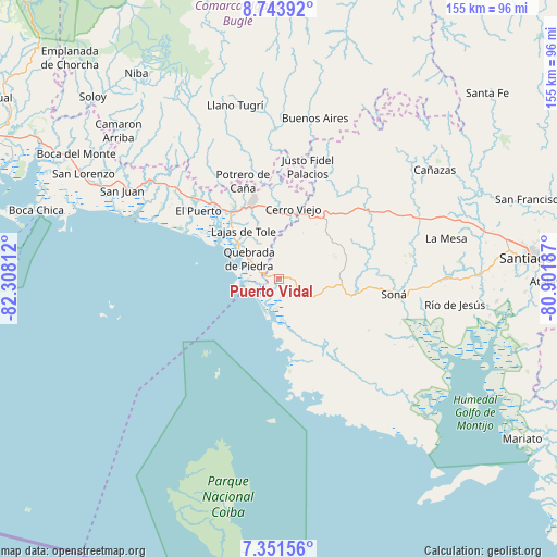
Puerto Vidal GPS coordinates[2]
8° 2' 54.024" North, 81° 36' 17.964" West
| Map corner | latitude | longitude |
|---|---|---|
| Upper-left | 8.74392°, | -82.30812° |
| Center: | 8.04834°, | -81.60499° |
| Lower-right: | 7.35156°, | -80.90187° |
| Map W x H: | 154.8×154.8 km | = 96.2×96.2mi |
| max Lat: | 9.60898° ⇑79.1% North |
| Puerto Vidal: | 8.04834° |
| min Lat: | ⇓20.9% South 7.26534° |
| min Long | Puerto Vidal | max Long |
| -82.91275° | -81.60499° | -77.38965° |
| W 28.7%⇐ | ⇒71.3% E |
Elevation
Elevation of Puerto Vidal is 4 m = 13 ft, and this is 168.1 m = 552 ft below average elevation for this country.
| Max E: |
2103 m = 6900 ft | 98.6% |
| Avg. | 172.1 m = 565 ft | |
| Puerto Vidal | 4 m = 13 ft | |
Min E: |
-1 m = -3 ft | 1.4% |
See also: Panama elevation on elevation.city.
Geographical zone
Puerto Vidal is located in North Torrid zone (between Equator and Tropic of Cancer). Distance of Equator is 894.9 km =556.1 mi to South.| Distance of | km | miles | from Puerto Vidal |
|---|---|---|---|
| North Pole | 9112.2 | 5662.1 | to North |
| Arctic Circle | 6506.3 | 4042.8 | to North |
| Tropic Cancer | 1711 | 1063.2 | to North |
| Equator | 894.9 | 556.1 | to South |


Nearby cities:
15 places around Puerto Vidal: (largest is in red/bold)
• Bella Vista
17.6 km =10.9 mi,  354°
354°
• Cerro Pelado
14.6 km =9.1 mi,  29°
29°
• Cerro Venado
20.3 km =12.6 mi,  9°
9°
• Cerro Viejo
23 km =14.3 mi, 7°
• Corozal
18.5 km =11.5 mi,  80°
80°
• El María
17.9 km =11.1 mi,  96°
96°
• El Piro
19.9 km =12.4 mi, 25°
• Lajas de Tolé
16.9 km =10.5 mi,  323°
323°
• Las Palmas
19 km =11.8 mi,  59°
59°
• Llano Limón
22.6 km =14 mi, 345°
• Lolá
15.5 km =9.6 mi,  71°
71°
• Quebrada de Piedra
9.6 km =6 mi,  301°
301°
• Tolé
22.5 km =14 mi,  340°
340°
• Veladero
21.1 km =13.1 mi, 345°
• Zapotillo
11.8 km =7.3 mi,  113°
113°
Sources, notices
• [Note1] Compared only with cities in Panama existing in our database
• [Src1] Map data: © OpenStreetMap contributors (CC-BY-SA)
• [Src2] Other city data from geonames.org with taken over terms of usage.
• [Src3] Geographical zone / Annual Mean Temperature by Robert A. Rohde @ Wikipedia
