Plan de Chorcha geodata
Plan de Chorcha (Ngöbe-Buglé) is a seat of a third-order administrative division; located in Panama in America/Panama (GMT-5) time zone. With population of 490 people, there are 493 cities with bigger population in this country. Compared to other cities in Panama, 51.6% of cities are located further ↑North; 80.4% of cities are located further →East and 79.6% of cities have lower elevation than Plan de Chorcha. Note1


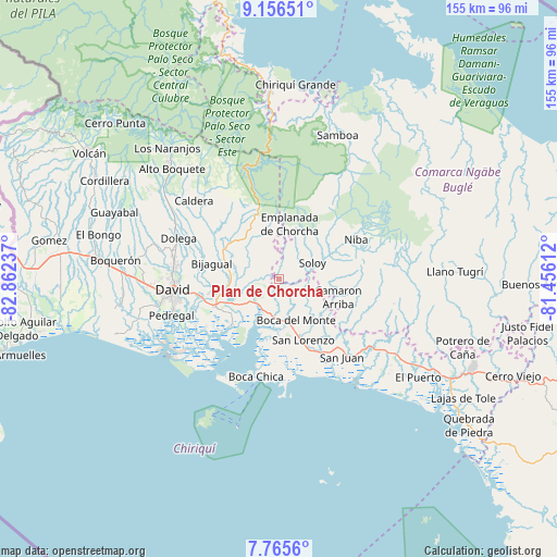
Plan de Chorcha GPS coordinates[2]
8° 27' 42.048" North, 82° 9' 33.264" West
| Map corner | latitude | longitude |
|---|---|---|
| Upper-left | 9.15651°, | -82.86237° |
| Center: | 8.46168°, | -82.15924° |
| Lower-right: | 7.7656°, | -81.45612° |
| Map W x H: | 154.7×154.7 km | = 96.1×96.1mi |
| max Lat: | 9.60898° ⇑51.6% North |
| Plan de Chorcha: | 8.46168° |
| min Lat: | ⇓48.4% South 7.26534° |
| min Long | Plan de Chorcha | max Long |
| -82.91275° | -82.15924° | -77.38965° |
| W 19.6%⇐ | ⇒80.4% E |
Elevation
Elevation of Plan de Chorcha is 256 m = 840 ft, and this is 83.9 m = 275 ft above average elevation for this country.
| Max E: |
2103 m = 6900 ft | 20.4% |
| Plan de Chorcha | 256 m 840 ft | |
| Avg. | 172.1 m = 565 ft | |
Min E: |
-1 m = -3 ft | 79.6% |
See also: Panama elevation on elevation.city.
Geographical zone
Plan de Chorcha is located in North Torrid zone (between Equator and Tropic of Cancer). Distance of Equator is 940.9 km =584.6 mi to South.| Distance of | km | miles | from Plan de Chorcha |
|---|---|---|---|
| North Pole | 9066.2 | 5633.5 | to North |
| Arctic Circle | 6460.3 | 4014.2 | to North |
| Tropic Cancer | 1665.1 | 1034.6 | to North |
| Equator | 940.9 | 584.6 | to South |


Nearby cities:
15 places around Plan de Chorcha: (largest is in red/bold)
• Bijagual
20.1 km =12.5 mi,  287°
287°
• Boca de Balsa
16 km =9.9 mi,  61°
61°
• Boca del Monte
13.1 km =8.1 mi,  157°
157°
• Camarón Arriba
20.2 km =12.6 mi,  115°
115°
• Cerro Banco
14.1 km =8.8 mi,  91°
91°
• Chiriquí
19.3 km =12 mi,  246°
246°
• Cochea Abajo
22.5 km =14 mi,  282°
282°
• Gualaca
17.2 km =10.7 mi,  296°
296°
• Guayabal
21.8 km =13.5 mi,  270°
270°
• Horconcitos
16.7 km =10.4 mi,  176°
176°
• Los Ángeles
8.1 km =5 mi,  326°
326°
• Pueblo Nuevo
19.1 km =11.9 mi, 160°
• Rincón
13.2 km =8.2 mi, 270°
• San Lorenzo
18.5 km =11.5 mi, 159°
• Soloy
10.2 km =6.3 mi,  72°
72°
Sources, notices
• [Note1] Compared only with cities in Panama existing in our database
• [Src1] Map data: © OpenStreetMap contributors (CC-BY-SA)
• [Src2] Other city data from geonames.org with taken over terms of usage.
• [Src3] Geographical zone / Annual Mean Temperature by Robert A. Rohde @ Wikipedia
