Nuevo San Juan geodata
Nuevo San Juan (Colón) is a seat of a third-order administrative division; located in Panama in America/Panama (GMT-5) time zone. With population of 1,494 people, there are 158 cities with bigger population in this country. Compared to other cities in Panama, 92.3% of cities are located further ↓South; 83.6% of cities are located further ←West and 66.5% of cities have higher elevation than Nuevo San Juan. Note1


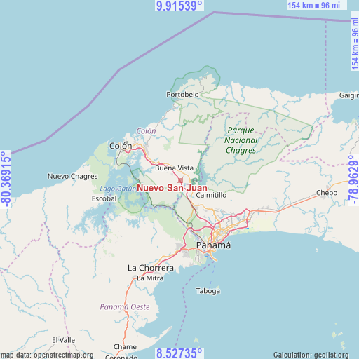
Nuevo San Juan GPS coordinates[2]
9° 13' 19.38" North, 79° 39' 57.672" West
| Map corner | latitude | longitude |
|---|---|---|
| Upper-left | 9.91539°, | -80.36915° |
| Center: | 9.22205°, | -79.66602° |
| Lower-right: | 8.52735°, | -78.9629° |
| Map W x H: | 154.3×154.3 km | = 95.9×95.9mi |
| max Lat: | 9.60898° ⇑7.7% North |
| Nuevo San Juan: | 9.22205° |
| min Lat: | ⇓92.3% South 7.26534° |
| min Long | Nuevo San Juan | max Long |
| -82.91275° | -79.66602° | -77.38965° |
| W 83.6%⇐ | ⇒16.4% E |
Elevation
Elevation of Nuevo San Juan is 40 m = 131 ft, and this is 132.1 m = 433 ft below average elevation for this country.
| Max E: |
2103 m = 6900 ft | 66.5% |
| Avg. | 172.1 m = 565 ft | |
| Nuevo San Juan | 40 m = 131 ft | |
Min E: |
-1 m = -3 ft | 33.5% |
See also: Panama elevation on elevation.city.
Geographical zone
Nuevo San Juan is located in North Torrid zone (between Equator and Tropic of Cancer). Distance of Equator is 1025.4 km =637.2 mi to South.| Distance of | km | miles | from Nuevo San Juan |
|---|---|---|---|
| North Pole | 8981.7 | 5581 | to North |
| Arctic Circle | 6375.8 | 3961.7 | to North |
| Tropic Cancer | 1580.5 | 982.1 | to North |
| Equator | 1025.4 | 637.2 | to South |


Nearby cities:
15 places around Nuevo San Juan: (largest is in red/bold)
• Buena Vista
6.6 km =4.1 mi,  330°
330°
• Calzada Larga
12.7 km =7.9 mi,  115°
115°
• Chilibre
9.3 km =5.8 mi,  147°
147°
• El Giral
3.9 km =2.4 mi,  311°
311°
• El Valle de la Unión
1.7 km =1.1 mi,  23°
23°
• Gatuncillo
3.1 km =1.9 mi,  38°
38°
• Gatún
13.8 km =8.6 mi,  302°
302°
• Nuevo Vigía
6.8 km =4.2 mi,  70°
70°
• Palenque
2.4 km =1.5 mi,  223°
223°
• Quebrada Bonita Adentro
9.4 km =5.8 mi, 332°
• Río Duque
4.1 km =2.5 mi,  339°
339°
• San Antonio
14.1 km =8.8 mi,  112°
112°
• San Vicente
14.1 km =8.8 mi, 147°
• Sardinilla
9 km =5.6 mi, 18°
• Villa Unida
5.8 km =3.6 mi,  128°
128°
Sources, notices
• [Note1] Compared only with cities in Panama existing in our database
• [Src1] Map data: © OpenStreetMap contributors (CC-BY-SA)
• [Src2] Other city data from geonames.org with taken over terms of usage.
• [Src3] Geographical zone / Annual Mean Temperature by Robert A. Rohde @ Wikipedia
