Nuevo Chagres geodata
Nuevo Chagres (Colón) is a seat of a second-order administrative division; located in Panama in America/Panama (GMT-5) time zone. With population of 410 people, there are 515 cities with bigger population in this country. Compared to other cities in Panama, 93.1% of cities are located further ↓South; 71.5% of cities are located further ←West and 79.6% of cities have higher elevation than Nuevo Chagres. Note1


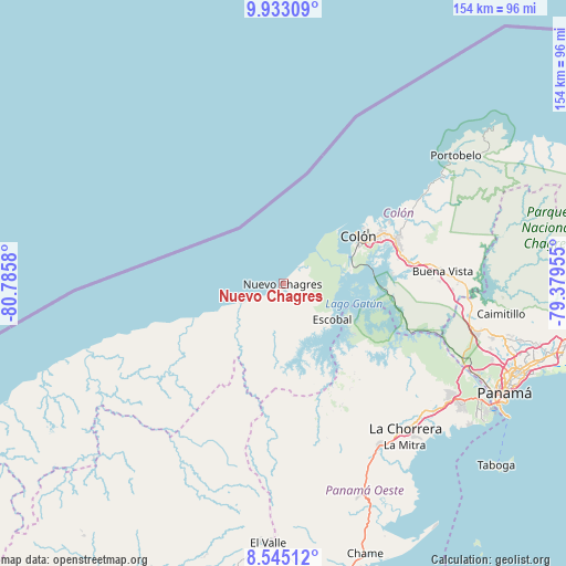
Nuevo Chagres GPS coordinates[2]
9° 14' 23.244" North, 80° 4' 57.612" West
| Map corner | latitude | longitude |
|---|---|---|
| Upper-left | 9.93309°, | -80.7858° |
| Center: | 9.23979°, | -80.08267° |
| Lower-right: | 8.54512°, | -79.37955° |
| Map W x H: | 154.3×154.3 km | = 95.9×95.9mi |
| max Lat: | 9.60898° ⇑6.9% North |
| Nuevo Chagres: | 9.23979° |
| min Lat: | ⇓93.1% South 7.26534° |
| min Long | Nuevo Chagres | max Long |
| -82.91275° | -80.08267° | -77.38965° |
| W 71.5%⇐ | ⇒28.5% E |
Elevation
Elevation of Nuevo Chagres is 24 m = 79 ft, and this is 148.1 m = 486 ft below average elevation for this country.
| Max E: |
2103 m = 6900 ft | 79.6% |
| Avg. | 172.1 m = 565 ft | |
| Nuevo Chagres | 24 m = 79 ft | |
Min E: |
-1 m = -3 ft | 20.4% |
See also: Panama elevation on elevation.city.
Geographical zone
Nuevo Chagres is located in North Torrid zone (between Equator and Tropic of Cancer). Distance of Equator is 1027.4 km =638.4 mi to South.| Distance of | km | miles | from Nuevo Chagres |
|---|---|---|---|
| North Pole | 8979.7 | 5579.7 | to North |
| Arctic Circle | 6373.8 | 3960.5 | to North |
| Tropic Cancer | 1578.6 | 980.9 | to North |
| Equator | 1027.4 | 638.4 | to South |


Nearby cities:
15 places around Nuevo Chagres: (largest is in red/bold)
• Achiote
8.2 km =5.1 mi,  112°
112°
• Boca de Río Indio
13.4 km =8.3 mi,  241°
241°
• Colón
23.7 km =14.7 mi,  57°
57°
• Cristóbal
23.2 km =14.4 mi, 57°
• Cuipo
19.4 km =12.1 mi,  168°
168°
• El Guabo
17.9 km =11.1 mi,  180°
180°
• Escobal
16.8 km =10.4 mi,  129°
129°
• Gobea
20.5 km =12.7 mi, 244°
• La Encantada
20.8 km =12.9 mi,  215°
215°
• Lagarterita
25.7 km =16 mi, 133°
• Las Margaritas
23.2 km =14.4 mi,  65°
65°
• Palmas Bellas
1.3 km =0.8 mi,  191°
191°
• Panama City
23.4 km =14.5 mi, 63°
• Puerto Escondido
5.2 km =3.2 mi, 186°
• Salud
7.1 km =4.4 mi,  229°
229°
Sources, notices
• [Note1] Compared only with cities in Panama existing in our database
• [Src1] Map data: © OpenStreetMap contributors (CC-BY-SA)
• [Src2] Other city data from geonames.org with taken over terms of usage.
• [Src3] Geographical zone / Annual Mean Temperature by Robert A. Rohde @ Wikipedia
