Llano Grande geodata
Llano Grande (Panamá) is a populated place; located in Panama in America/Panama (GMT-5) time zone. With population of 556 people, there are 437 cities with bigger population in this country. Compared to other cities in Panama, 66% of cities are located further ↓South; 74.4% of cities are located further ←West and 56.3% of cities have higher elevation than Llano Grande. Note1


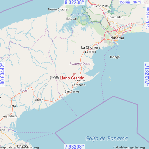
Llano Grande GPS coordinates[2]
8° 37' 40.332" North, 79° 55' 52.644" West
| Map corner | latitude | longitude |
|---|---|---|
| Upper-left | 9.32238°, | -80.63442° |
| Center: | 8.62787°, | -79.93129° |
| Lower-right: | 7.93208°, | -79.22817° |
| Map W x H: | 154.6×154.6 km | = 96.1×96.1mi |
| max Lat: | 9.60898° ⇑34% North |
| Llano Grande: | 8.62787° |
| min Lat: | ⇓66% South 7.26534° |
| min Long | Llano Grande | max Long |
| -82.91275° | -79.93129° | -77.38965° |
| W 74.4%⇐ | ⇒25.6% E |
Elevation
Elevation of Llano Grande is 61 m = 200 ft, and this is 111.1 m = 365 ft below average elevation for this country.
| Max E: |
2103 m = 6900 ft | 56.3% |
| Avg. | 172.1 m = 565 ft | |
| Llano Grande | 61 m = 200 ft | |
Min E: |
-1 m = -3 ft | 43.7% |
See also: Panama elevation on elevation.city.
Geographical zone
Llano Grande is located in North Torrid zone (between Equator and Tropic of Cancer). Distance of Equator is 959.3 km =596.1 mi to South.| Distance of | km | miles | from Llano Grande |
|---|---|---|---|
| North Pole | 9047.7 | 5622 | to North |
| Arctic Circle | 6441.8 | 4002.7 | to North |
| Tropic Cancer | 1646.6 | 1023.1 | to North |
| Equator | 959.3 | 596.1 | to South |


Nearby cities:
15 places around Llano Grande: (largest is in red/bold)
• Bejuco
5.5 km =3.4 mi,  123°
123°
• Buenos Aires
1.9 km =1.2 mi,  282°
282°
• Cabuya
5.9 km =3.7 mi,  175°
175°
• Cerro Campana
9 km =5.6 mi,  13°
13°
• Chame
7.5 km =4.7 mi,  138°
138°
• Coloncito
8 km =5 mi,  154°
154°
• El Alto de Capira
12.6 km =7.8 mi,  22°
22°
• El Espavé
7.2 km =4.5 mi,  58°
58°
• El Líbano
10.7 km =6.6 mi,  96°
96°
• La Cresta
5.5 km =3.4 mi,  76°
76°
• Las Lajas
8.7 km =5.4 mi, 182°
• Nueva Gorgona
10.6 km =6.6 mi, 144°
• Sajalices
9.2 km =5.7 mi,  49°
49°
• San José
10.6 km =6.6 mi, 179°
• Sorá
8.5 km =5.3 mi,  273°
273°
Sources, notices
• [Note1] Compared only with cities in Panama existing in our database
• [Src1] Map data: © OpenStreetMap contributors (CC-BY-SA)
• [Src2] Other city data from geonames.org with taken over terms of usage.
• [Src3] Geographical zone / Annual Mean Temperature by Robert A. Rohde @ Wikipedia
