El Espavé geodata
El Espavé (Panamá Oeste) is a populated place; located in Panama in America/Panama (GMT-5) time zone. With population of 1,236 people, there are 196 cities with bigger population in this country. Compared to other cities in Panama, 68.1% of cities are located further ↓South; 77.1% of cities are located further ←West and 84.5% of cities have higher elevation than El Espavé. Note1


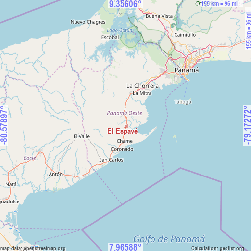
El Espavé GPS coordinates[2]
8° 39' 41.796" North, 79° 52' 33.024" West
| Map corner | latitude | longitude |
|---|---|---|
| Upper-left | 9.35606°, | -80.57897° |
| Center: | 8.66161°, | -79.87584° |
| Lower-right: | 7.96588°, | -79.17272° |
| Map W x H: | 154.6×154.6 km | = 96.1×96.1mi |
| max Lat: | 9.60898° ⇑31.9% North |
| El Espavé: | 8.66161° |
| min Lat: | ⇓68.1% South 7.26534° |
| min Long | El Espavé | max Long |
| -82.91275° | -79.87584° | -77.38965° |
| W 77.1%⇐ | ⇒22.9% E |
Elevation
Elevation of El Espavé is 18 m = 59 ft, and this is 154.1 m = 506 ft below average elevation for this country.
| Max E: |
2103 m = 6900 ft | 84.5% |
| Avg. | 172.1 m = 565 ft | |
| El Espavé | 18 m = 59 ft | |
Min E: |
-1 m = -3 ft | 15.5% |
See also: Panama elevation on elevation.city.
Geographical zone
El Espavé is located in North Torrid zone (between Equator and Tropic of Cancer). Distance of Equator is 963.1 km =598.4 mi to South.| Distance of | km | miles | from El Espavé |
|---|---|---|---|
| North Pole | 9044 | 5619.7 | to North |
| Arctic Circle | 6438.1 | 4000.4 | to North |
| Tropic Cancer | 1642.8 | 1020.8 | to North |
| Equator | 963.1 | 598.4 | to South |


Nearby cities:
15 places around El Espavé: (largest is in red/bold)
• Bejuco
7 km =4.3 mi,  192°
192°
• Buenos Aires
8.6 km =5.3 mi,  247°
247°
• Cabuya
11.2 km =7 mi,  210°
210°
• Capira
10.5 km =6.5 mi,  357°
357°
• Cermeño
9.2 km =5.7 mi,  15°
15°
• Cerro Campana
6.4 km =4 mi,  321°
321°
• Chame
9.4 km =5.8 mi, 186°
• Coloncito
11.3 km =7 mi, 193°
• El Alto de Capira
8 km =5 mi,  350°
350°
• El Líbano
6.7 km =4.2 mi,  137°
137°
• La Cresta
2.5 km =1.6 mi,  196°
196°
• Llano Grande
7.2 km =4.5 mi,  238°
238°
• Llano de Santa Rosa
11.1 km =6.9 mi,  7°
7°
• Lídice
10.4 km =6.5 mi,  338°
338°
• Sajalices
2.4 km =1.5 mi, 21°
Sources, notices
• [Note1] Compared only with cities in Panama existing in our database
• [Src1] Map data: © OpenStreetMap contributors (CC-BY-SA)
• [Src2] Other city data from geonames.org with taken over terms of usage.
• [Src3] Geographical zone / Annual Mean Temperature by Robert A. Rohde @ Wikipedia
