Las Delicias geodata
Las Delicias (Coclé) is a populated place; located in Panama in America/Panama (GMT-5) time zone. With population of 693 people, there are 359 cities with bigger population in this country. Compared to other cities in Panama, 58.2% of cities are located further ↓South; 59.1% of cities are located further ←West and 55.5% of cities have lower elevation than Las Delicias. Note1


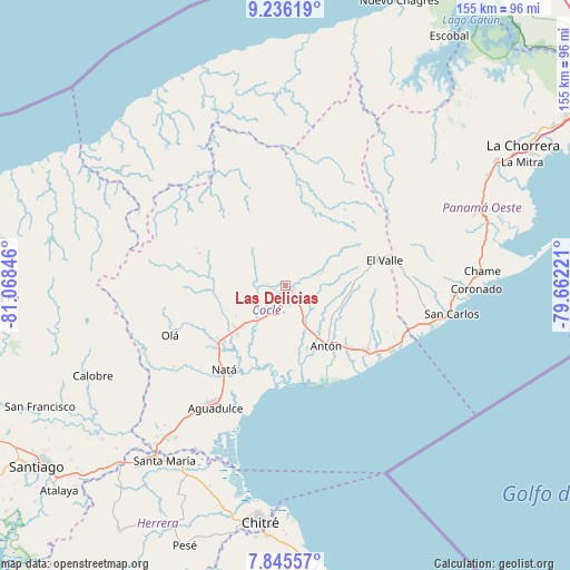
Las Delicias GPS coordinates[2]
8° 32' 29.436" North, 80° 21' 55.188" West
| Map corner | latitude | longitude |
|---|---|---|
| Upper-left | 9.23619°, | -81.06846° |
| Center: | 8.54151°, | -80.36533° |
| Lower-right: | 7.84557°, | -79.66221° |
| Map W x H: | 154.6×154.6 km | = 96.1×96.1mi |
| max Lat: | 9.60898° ⇑41.8% North |
| Las Delicias: | 8.54151° |
| min Lat: | ⇓58.2% South 7.26534° |
| min Long | Las Delicias | max Long |
| -82.91275° | -80.36533° | -77.38965° |
| W 59.1%⇐ | ⇒40.9% E |
Elevation
Elevation of Las Delicias is 90 m = 295 ft, and this is 82.1 m = 269 ft below average elevation for this country.
| Max E: |
2103 m = 6900 ft | 44.5% |
| Avg. | 172.1 m = 565 ft | |
| Las Delicias | 90 m = 295 ft | |
Min E: |
-1 m = -3 ft | 55.5% |
See also: Panama elevation on elevation.city.
Geographical zone
Las Delicias is located in North Torrid zone (between Equator and Tropic of Cancer). Distance of Equator is 949.7 km =590.1 mi to South.| Distance of | km | miles | from Las Delicias |
|---|---|---|---|
| North Pole | 9057.3 | 5627.9 | to North |
| Arctic Circle | 6451.4 | 4008.7 | to North |
| Tropic Cancer | 1656.2 | 1029.1 | to North |
| Equator | 949.7 | 590.1 | to South |


Nearby cities:
15 places around Las Delicias: (largest is in red/bold)
• Aguas Blancas
7.3 km =4.5 mi,  125°
125°
• Bella Vista
4.6 km =2.9 mi,  271°
271°
• Cañaveral
7.5 km =4.7 mi,  248°
248°
• Chigoré
2 km =1.2 mi, 128°
• Churuquita Chiquita
11 km =6.8 mi,  69°
69°
• Churuquita Grande
11.8 km =7.3 mi,  60°
60°
• Coclé
11.8 km =7.3 mi,  216°
216°
• La Pintada
10.3 km =6.4 mi,  303°
303°
• Las Lomas
3.8 km =2.4 mi,  194°
194°
• Las Minas
11.5 km =7.1 mi,  343°
343°
• Llano Marín
8.4 km =5.2 mi,  148°
148°
• Los Uveros
3.6 km =2.2 mi, 246°
• Penonomé
2.7 km =1.7 mi,  160°
160°
• Sonadora
4.3 km =2.7 mi, 74°
• Vista Hermosa
1.9 km =1.2 mi,  212°
212°
Sources, notices
• [Note1] Compared only with cities in Panama existing in our database
• [Src1] Map data: © OpenStreetMap contributors (CC-BY-SA)
• [Src2] Other city data from geonames.org with taken over terms of usage.
• [Src3] Geographical zone / Annual Mean Temperature by Robert A. Rohde @ Wikipedia
