Vista Hermosa geodata
Vista Hermosa (Coclé) is a populated place; located in Panama in America/Panama (GMT-5) time zone. With population of 3,063 people, there are 93 cities with bigger population in this country. Compared to other cities in Panama, 56% of cities are located further ↓South; 58.7% of cities are located further ←West and 54.8% of cities have lower elevation than Vista Hermosa. Note1


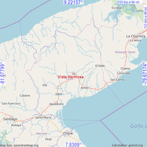
Vista Hermosa GPS coordinates[2]
8° 31' 36.732" North, 80° 22' 29.496" West
| Map corner | latitude | longitude |
|---|---|---|
| Upper-left | 9.22157°, | -81.07799° |
| Center: | 8.52687°, | -80.37486° |
| Lower-right: | 7.8309°, | -79.67174° |
| Map W x H: | 154.6×154.6 km | = 96.1×96.1mi |
| max Lat: | 9.60898° ⇑44% North |
| Vista Hermosa: | 8.52687° |
| min Lat: | ⇓56% South 7.26534° |
| min Long | Vista Hermosa | max Long |
| -82.91275° | -80.37486° | -77.38965° |
| W 58.7%⇐ | ⇒41.3% E |
Elevation
Elevation of Vista Hermosa is 87 m = 285 ft, and this is 85.1 m = 279 ft below average elevation for this country.
| Max E: |
2103 m = 6900 ft | 45.2% |
| Avg. | 172.1 m = 565 ft | |
| Vista Hermosa | 87 m = 285 ft | |
Min E: |
-1 m = -3 ft | 54.8% |
See also: Panama elevation on elevation.city.
Geographical zone
Vista Hermosa is located in North Torrid zone (between Equator and Tropic of Cancer). Distance of Equator is 948.1 km =589.1 mi to South.| Distance of | km | miles | from Vista Hermosa |
|---|---|---|---|
| North Pole | 9059 | 5629 | to North |
| Arctic Circle | 6453.1 | 4009.8 | to North |
| Tropic Cancer | 1657.8 | 1030.1 | to North |
| Equator | 948.1 | 589.1 | to South |


Nearby cities:
15 places around Vista Hermosa: (largest is in red/bold)
• Aguas Blancas
7.4 km =4.6 mi,  110°
110°
• Bella Vista
3.9 km =2.4 mi,  296°
296°
• Cañaveral
6.1 km =3.8 mi,  259°
259°
• Chigoré
2.6 km =1.6 mi,  81°
81°
• Ciruelito
11.6 km =7.2 mi,  225°
225°
• Coclé
9.9 km =6.2 mi,  217°
217°
• El Congo
11.3 km =7 mi,  207°
207°
• Juan Díaz
12.4 km =7.7 mi,  125°
125°
• La Pintada
10.5 km =6.5 mi,  314°
314°
• Las Delicias
1.9 km =1.2 mi,  32°
32°
• Las Lomas
2.1 km =1.3 mi,  176°
176°
• Llano Marín
7.8 km =4.8 mi,  135°
135°
• Los Uveros
2.2 km =1.4 mi,  275°
275°
• Penonomé
2.1 km =1.3 mi, 114°
• Sonadora
5.9 km =3.7 mi,  62°
62°
Sources, notices
• [Note1] Compared only with cities in Panama existing in our database
• [Src1] Map data: © OpenStreetMap contributors (CC-BY-SA)
• [Src2] Other city data from geonames.org with taken over terms of usage.
• [Src3] Geographical zone / Annual Mean Temperature by Robert A. Rohde @ Wikipedia
