Los Uveros geodata
Los Uveros (Coclé) is a populated place; located in Panama in America/Panama (GMT-5) time zone. With population of 999 people, there are 258 cities with bigger population in this country. Compared to other cities in Panama, 56.3% of cities are located further ↓South; 57.7% of cities are located further ←West and 55% of cities have higher elevation than Los Uveros. Note1


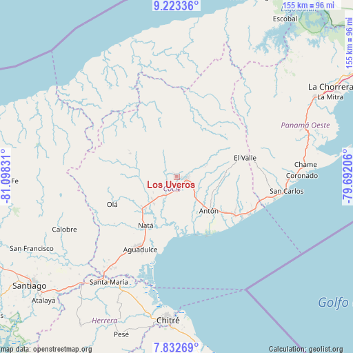
Los Uveros GPS coordinates[2]
8° 31' 43.176" North, 80° 23' 42.648" West
| Map corner | latitude | longitude |
|---|---|---|
| Upper-left | 9.22336°, | -81.09831° |
| Center: | 8.52866°, | -80.39518° |
| Lower-right: | 7.83269°, | -79.69206° |
| Map W x H: | 154.6×154.6 km | = 96.1×96.1mi |
| max Lat: | 9.60898° ⇑43.7% North |
| Los Uveros: | 8.52866° |
| min Lat: | ⇓56.3% South 7.26534° |
| min Long | Los Uveros | max Long |
| -82.91275° | -80.39518° | -77.38965° |
| W 57.7%⇐ | ⇒42.3% E |
Elevation
Elevation of Los Uveros is 63 m = 207 ft, and this is 109.1 m = 358 ft below average elevation for this country.
| Max E: |
2103 m = 6900 ft | 55% |
| Avg. | 172.1 m = 565 ft | |
| Los Uveros | 63 m = 207 ft | |
Min E: |
-1 m = -3 ft | 45% |
See also: Panama elevation on elevation.city.
Geographical zone
Los Uveros is located in North Torrid zone (between Equator and Tropic of Cancer). Distance of Equator is 948.3 km =589.2 mi to South.| Distance of | km | miles | from Los Uveros |
|---|---|---|---|
| North Pole | 9058.8 | 5628.9 | to North |
| Arctic Circle | 6452.9 | 4009.6 | to North |
| Tropic Cancer | 1657.6 | 1030 | to North |
| Equator | 948.3 | 589.2 | to South |


Nearby cities:
15 places around Los Uveros: (largest is in red/bold)
• Aguas Blancas
9.6 km =6 mi,  106°
106°
• Bella Vista
2 km =1.2 mi,  320°
320°
• Cañaveral
4 km =2.5 mi,  250°
250°
• Chigoré
4.8 km =3 mi,  87°
87°
• Ciruelito
10.3 km =6.4 mi,  215°
215°
• Coclé
8.9 km =5.5 mi,  204°
204°
• El Congo
10.6 km =6.6 mi, 196°
• La Pintada
8.9 km =5.5 mi, 323°
• Las Delicias
3.6 km =2.2 mi,  66°
66°
• Las Lomas
3.3 km =2.1 mi,  134°
134°
• Las Minas
12.5 km =7.8 mi,  0°
0°
• Llano Marín
9.6 km =6 mi, 126°
• Penonomé
4.3 km =2.7 mi,  104°
104°
• Sonadora
7.9 km =4.9 mi, 71°
• Vista Hermosa
2.2 km =1.4 mi, 95°
Sources, notices
• [Note1] Compared only with cities in Panama existing in our database
• [Src1] Map data: © OpenStreetMap contributors (CC-BY-SA)
• [Src2] Other city data from geonames.org with taken over terms of usage.
• [Src3] Geographical zone / Annual Mean Temperature by Robert A. Rohde @ Wikipedia
