Hicaco geodata
Hicaco (Veraguas) is a populated place; located in Panama in America/Panama (GMT-5) time zone. With population of 520 people, there are 473 cities with bigger population in this country. Compared to other cities in Panama, 96% of cities are located further ↑North; 65.1% of cities are located further →East and 80.4% of cities have higher elevation than Hicaco. Note1


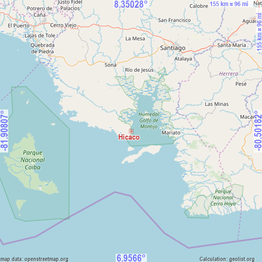
Hicaco GPS coordinates[2]
7° 39' 14.436" North, 81° 12' 17.784" West
| Map corner | latitude | longitude |
|---|---|---|
| Upper-left | 8.35028°, | -81.90807° |
| Center: | 7.65401°, | -81.20494° |
| Lower-right: | 6.9566°, | -80.50182° |
| Map W x H: | 155×155 km | = 96.3×96.3mi |
| max Lat: | 9.60898° ⇑96% North |
| Hicaco: | 7.65401° |
| min Lat: | ⇓4% South 7.26534° |
| min Long | Hicaco | max Long |
| -82.91275° | -81.20494° | -77.38965° |
| W 34.9%⇐ | ⇒65.1% E |
Elevation
Elevation of Hicaco is 23 m = 75 ft, and this is 149.1 m = 489 ft below average elevation for this country.
| Max E: |
2103 m = 6900 ft | 80.4% |
| Avg. | 172.1 m = 565 ft | |
| Hicaco | 23 m = 75 ft | |
Min E: |
-1 m = -3 ft | 19.6% |
See also: Panama elevation on elevation.city.
Geographical zone
Hicaco is located in North Torrid zone (between Equator and Tropic of Cancer). Distance of Equator is 851 km =528.8 mi to South.| Distance of | km | miles | from Hicaco |
|---|---|---|---|
| North Pole | 9156 | 5689.3 | to North |
| Arctic Circle | 6550.1 | 4070 | to North |
| Tropic Cancer | 1754.9 | 1090.4 | to North |
| Equator | 851 | 528.8 | to South |


Nearby cities:
15 places around Hicaco: (largest is in red/bold)
• El Pilón
36.3 km =22.6 mi,  22°
22°
• El Pájaro
34.5 km =21.4 mi, 15°
• Guarumal
16.7 km =10.4 mi,  339°
339°
• La Punta
10.9 km =6.8 mi,  171°
171°
• La Soledad
26.2 km =16.3 mi, 342°
• Las Huacas
28.4 km =17.6 mi,  14°
14°
• Leones Arriba
14.9 km =9.3 mi,  41°
41°
• Limón de Tijeras
36.9 km =22.9 mi,  60°
60°
• Ponuga
35.6 km =22.1 mi, 44°
• Rincón Largo
35.8 km =22.2 mi,  25°
25°
• Río Grande
16 km =9.9 mi,  296°
296°
• Río de Jesús
36.4 km =22.6 mi, 7°
• Santa Catalina
5.9 km =3.7 mi,  245°
245°
• Tebario
25.8 km =16 mi,  75°
75°
• Utirá
35.4 km =22 mi,  357°
357°
Sources, notices
• [Note1] Compared only with cities in Panama existing in our database
• [Src1] Map data: © OpenStreetMap contributors (CC-BY-SA)
• [Src2] Other city data from geonames.org with taken over terms of usage.
• [Src3] Geographical zone / Annual Mean Temperature by Robert A. Rohde @ Wikipedia
