Guarumal geodata
Guarumal (Chiriquí) is a seat of a third-order administrative division; located in Panama in America/Panama (GMT-5) time zone. With population of 1,575 people, there are 149 cities with bigger population in this country. Compared to other cities in Panama, 63.6% of cities are located further ↑North; 89.9% of cities are located further →East and 93.8% of cities have higher elevation than Guarumal. Note1


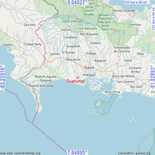
Guarumal GPS coordinates[2]
8° 20' 42.828" North, 82° 31' 55.38" West
| Map corner | latitude | longitude |
|---|---|---|
| Upper-left | 9.04027°, | -83.23518° |
| Center: | 8.34523°, | -82.53205° |
| Lower-right: | 7.64895°, | -81.82893° |
| Map W x H: | 154.7×154.7 km | = 96.1×96.1mi |
| max Lat: | 9.60898° ⇑63.6% North |
| Guarumal: | 8.34523° |
| min Lat: | ⇓36.4% South 7.26534° |
| min Long | Guarumal | max Long |
| -82.91275° | -82.53205° | -77.38965° |
| W 10.1%⇐ | ⇒89.9% E |
Elevation
Elevation of Guarumal is 9 m = 30 ft, and this is 163.1 m = 535 ft below average elevation for this country.
| Max E: |
2103 m = 6900 ft | 93.8% |
| Avg. | 172.1 m = 565 ft | |
| Guarumal | 9 m = 30 ft | |
Min E: |
-1 m = -3 ft | 6.2% |
See also: Panama elevation on elevation.city.
Geographical zone
Guarumal is located in North Torrid zone (between Equator and Tropic of Cancer). Distance of Equator is 927.9 km =576.6 mi to South.| Distance of | km | miles | from Guarumal |
|---|---|---|---|
| North Pole | 9079.2 | 5641.6 | to North |
| Arctic Circle | 6473.3 | 4022.3 | to North |
| Tropic Cancer | 1678 | 1042.7 | to North |
| Equator | 927.9 | 576.6 | to South |


Nearby cities:
15 places around Guarumal: (largest is in red/bold)
• Alanje
6.6 km =4.1 mi,  332°
332°
• Bágala
13.2 km =8.2 mi,  2°
2°
• David
14.4 km =8.9 mi,  50°
50°
• El Tejar
10.4 km =6.5 mi, 334°
• Loma de San Pedro
9.2 km =5.7 mi,  346°
346°
• Montilla
14.4 km =8.9 mi,  23°
23°
• Orillas del Río
3.2 km =2 mi,  56°
56°
• Palo Grande
8.1 km =5 mi,  271°
271°
• Pedregal
10.9 km =6.8 mi,  77°
77°
• Querévalo
3 km =1.9 mi,  11°
11°
• San Pablo Nuevo Abajo
9.5 km =5.9 mi, 20°
• San Pablo Viejo Abajo
12.5 km =7.8 mi, 15°
• Santo Tomás
13.9 km =8.6 mi,  290°
290°
• Tijeras
14.8 km =9.2 mi, 347°
• Veladero
10.5 km =6.5 mi,  338°
338°
Sources, notices
• [Note1] Compared only with cities in Panama existing in our database
• [Src1] Map data: © OpenStreetMap contributors (CC-BY-SA)
• [Src2] Other city data from geonames.org with taken over terms of usage.
• [Src3] Geographical zone / Annual Mean Temperature by Robert A. Rohde @ Wikipedia
