Bágala geodata
Bágala (Chiriquí) is a seat of a third-order administrative division; located in Panama in America/Panama (GMT-5) time zone. With population of 910 people, there are 281 cities with bigger population in this country. Compared to other cities in Panama, 50.9% of cities are located further ↑North; 89.5% of cities are located further →East and 57.7% of cities have lower elevation than Bágala. Note1


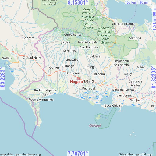
Bágala GPS coordinates[2]
8° 27' 50.364" North, 82° 31' 34.212" West
| Map corner | latitude | longitude |
|---|---|---|
| Upper-left | 9.15881°, | -83.2293° |
| Center: | 8.46399°, | -82.52617° |
| Lower-right: | 7.76791°, | -81.82305° |
| Map W x H: | 154.7×154.7 km | = 96.1×96.1mi |
| max Lat: | 9.60898° ⇑50.9% North |
| Bágala: | 8.46399° |
| min Lat: | ⇓49.1% South 7.26534° |
| min Long | Bágala | max Long |
| -82.91275° | -82.52617° | -77.38965° |
| W 10.5%⇐ | ⇒89.5% E |
Elevation
Elevation of Bágala is 95 m = 312 ft, and this is 77.1 m = 253 ft below average elevation for this country.
| Max E: |
2103 m = 6900 ft | 42.3% |
| Avg. | 172.1 m = 565 ft | |
| Bágala | 95 m = 312 ft | |
Min E: |
-1 m = -3 ft | 57.7% |
See also: Panama elevation on elevation.city.
Geographical zone
Bágala is located in North Torrid zone (between Equator and Tropic of Cancer). Distance of Equator is 941.1 km =584.8 mi to South.| Distance of | km | miles | from Bágala |
|---|---|---|---|
| North Pole | 9066 | 5633.3 | to North |
| Arctic Circle | 6460.1 | 4014.1 | to North |
| Tropic Cancer | 1664.8 | 1034.5 | to North |
| Equator | 941.1 | 584.8 | to South |


Nearby cities:
15 places around Bágala: (largest is in red/bold)
• Aguacatal
7.8 km =4.8 mi,  92°
92°
• Alanje
8.2 km =5.1 mi,  206°
206°
• Boquerón
6.7 km =4.2 mi,  313°
313°
• Chacarero
8.4 km =5.2 mi,  289°
289°
• El Tejar
6.4 km =4 mi,  233°
233°
• Loma de San Pedro
5.1 km =3.2 mi, 213°
• Montilla
5.1 km =3.2 mi, 89°
• Pueblo Nuevo
7.9 km =4.9 mi,  17°
17°
• San Carlos
6.1 km =3.8 mi, 17°
• San Juan del Tejal
4.6 km =2.9 mi,  55°
55°
• San Pablo Nuevo Abajo
5 km =3.1 mi,  147°
147°
• San Pablo Viejo Abajo
2.9 km =1.8 mi,  113°
113°
• San Pablo Viejo Arriba
3 km =1.9 mi,  52°
52°
• Tijeras
4 km =2.5 mi, 288°
• Veladero
5.6 km =3.5 mi, 232°
Sources, notices
• [Note1] Compared only with cities in Panama existing in our database
• [Src1] Map data: © OpenStreetMap contributors (CC-BY-SA)
• [Src2] Other city data from geonames.org with taken over terms of usage.
• [Src3] Geographical zone / Annual Mean Temperature by Robert A. Rohde @ Wikipedia
