Altos de Güera geodata
Altos de Güera (Los Santos) is a seat of a third-order administrative division; located in Panama in America/Panama (GMT-5) time zone. In our database, there are 694 cities with bigger population. Compared to other cities in Panama, 98.2% of cities are located further ↑North; 51.6% of cities are located further →East and 75.3% of cities have lower elevation than Altos de Güera. Note1


Altos de Güera GPS coordinates[2]
7° 31' 48.072" North, 80° 37' 15.924" West
| Map corner | latitude | longitude |
|---|---|---|
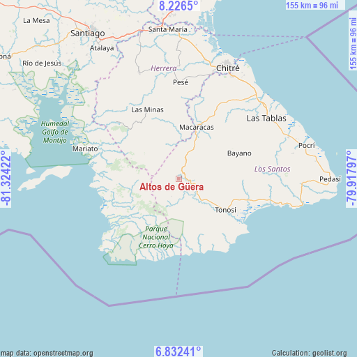
| Upper-left | 8.2265°, | -81.32422° |
| Center: | 7.53002°, | -80.62109° |
| Lower-right: | 6.83241°, | -79.91797° |
| Map W x H: | 155×155 km | = 96.3×96.3mi |
| max Lat: | 9.60898° ⇑98.2% North |
| Altos de Güera: | 7.53002° |
| min Lat: | ⇓1.8% South 7.26534° |
| min Long | Altos de Güera | max Long |
| -82.91275° | -80.62109° | -77.38965° |
| W 48.4%⇐ | ⇒51.6% E |
Elevation
Elevation of Altos de Güera is 203 m = 666 ft, and this is 30.9 m = 101 ft above average elevation for this country.
| Max E: |
2103 m = 6900 ft | 24.7% |
| Altos de Güera | 203 m 666 ft | |
| Avg. | 172.1 m = 565 ft | |
Min E: |
-1 m = -3 ft | 75.3% |
See also: Panama elevation on elevation.city.
Geographical zone
Altos de Güera is located in North Torrid zone (between Equator and Tropic of Cancer). Distance of Equator is 837.3 km =520.3 mi to South.| Distance of | km | miles | from Altos de Güera |
|---|---|---|---|
| North Pole | 9169.8 | 5697.8 | to North |
| Arctic Circle | 6563.9 | 4078.6 | to North |
| Tropic Cancer | 1768.7 | 1099 | to North |
| Equator | 837.3 | 520.3 | to South |


Nearby cities:
15 places around Altos de Güera: (largest is in red/bold)
• Bajos de Güera
1.6 km =1 mi,  343°
343°
• El Bebedero
22.6 km =14 mi,  126°
126°
• El Calabacito
21.1 km =13.1 mi,  7°
7°
• El Capurí
21.9 km =13.6 mi,  353°
353°
• El Cedro
17.8 km =11.1 mi, 346°
• El Cortezo
11.6 km =7.2 mi,  186°
186°
• La Mesa
14.1 km =8.8 mi,  1°
1°
• La Tronosa
11.1 km =6.9 mi,  160°
160°
• Las Palmas
21.8 km =13.5 mi,  38°
38°
• Llano de Piedra
15.8 km =9.8 mi,  23°
23°
• Los Cerros de Paja
21.7 km =13.5 mi, 344°
• Macaracas
23.6 km =14.7 mi, 18°
• Mogollón
21.8 km =13.5 mi,  54°
54°
• Pitaloza Arriba
13.5 km =8.4 mi, 337°
• Tonosí
24 km =14.9 mi,  124°
124°
Sources, notices
• [Note1] Compared only with cities in Panama existing in our database
• [Src1] Map data: © OpenStreetMap contributors (CC-BY-SA)
• [Src2] Other city data from geonames.org with taken over terms of usage.
• [Src3] Geographical zone / Annual Mean Temperature by Robert A. Rohde @ Wikipedia
