Tantamayo geodata
Tantamayo (Huanuco) is a seat of a third-order administrative division; located in Peru in America/Lima (GMT-5) time zone. In our database, there are 305 cities with bigger population. Compared to other cities in Peru, 65.3% of cities are located further ↓South; 62.8% of cities are located further →East and 84.1% of cities have lower elevation than Tantamayo. Note1


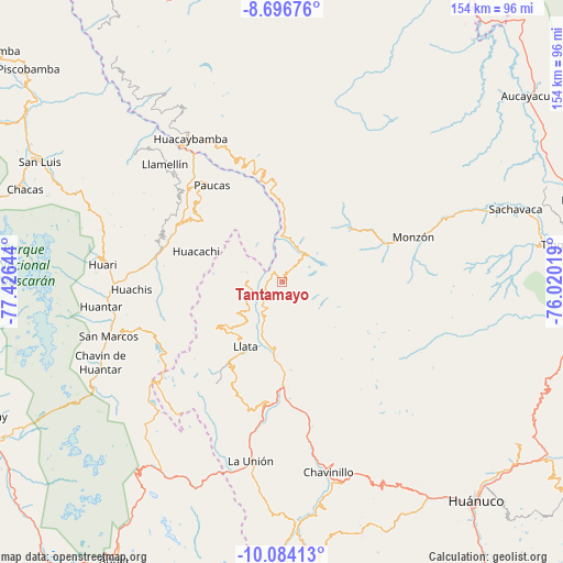
Tantamayo GPS coordinates[2]
9° 23' 28.104" South, 76° 43' 23.916" West
| Map corner | latitude | longitude |
|---|---|---|
| Upper-left | -8.69676°, | -77.42644° |
| Center: | -9.39114°, | -76.72331° |
| Lower-right: | -10.08413°, | -76.02019° |
| Map W x H: | 154.3×154.3 km | = 95.9×95.9mi |
| max Lat: | -0.96667° ⇑34.7% North |
| Tantamayo: | -9.39114° |
| min Lat: | ⇓65.3% South -18.01465° |
| min Long | Tantamayo | max Long |
| -81.30472° | -76.72331° | -69.04167° |
| W 37.2%⇐ | ⇒62.8% E |
Elevation
Elevation of Tantamayo is 3623 m = 11886 ft, and this is 1304.3 m = 4279 ft above average elevation for this country.
| Max E: |
5022 m = 16476 ft | 15.9% |
| Tantamayo | 3623 m 11886 ft | |
| Avg. | 2318.7 m = 7607 ft | |
Min E: |
1 m = 3 ft | 84.1% |
See also: Peru elevation on elevation.city.
Geographical zone
Tantamayo is located in South Torrid zone (between Equator and Tropic of Capricorn). Distance of Equator is 1044.2 km =648.8 mi to North.| Distance of | km | miles | from Tantamayo |
|---|---|---|---|
| Equator | 1044.2 | 648.8 | to North |
| Tropic Capricorn | 1561.7 | 970.4 | to South |
| Antarctic Circle | 6357 | 3950.1 | to South |
| South Pole | 8962.9 | 5569.3 | to South |


Nearby cities:
15 places around Tantamayo: (largest is in red/bold)
• Anra
28.1 km =17.5 mi,  308°
308°
• Arancay
24.5 km =15.2 mi,  353°
353°
• Chuquis
31.8 km =19.8 mi,  176°
176°
• Huacachi
25.1 km =15.6 mi,  289°
289°
• Huacchis
22.4 km =13.9 mi,  341°
341°
• Jacas Grande
16.6 km =10.3 mi, 184°
• Llata
7.2 km =4.5 mi,  246°
246°
• Llata
20.4 km =12.7 mi,  209°
209°
• Miraflores
15.5 km =9.6 mi,  222°
222°
• Punchao
13.2 km =8.2 mi,  233°
233°
• Puños
21.3 km =13.2 mi,  236°
236°
• Quivilla
23.1 km =14.4 mi, 180°
• Rapayan
21.3 km =13.2 mi, 349°
• Singa
9.8 km =6.1 mi,  272°
272°
• Uco
31.8 km =19.8 mi,  315°
315°
Sources, notices
• [Note1] Compared only with cities in Peru existing in our database
• [Src1] Map data: © OpenStreetMap contributors (CC-BY-SA)
• [Src2] Other city data from geonames.org with taken over terms of usage.
• [Src3] Geographical zone / Annual Mean Temperature by Robert A. Rohde @ Wikipedia
