Llata geodata
Llata (Huanuco) is a populated place; located in Peru in America/Lima (GMT-5) time zone. With population of 4,585 people, there are 244 cities with bigger population in this country. Compared to other cities in Peru, 65% of cities are located further ↓South; 64.4% of cities are located further →East and 50.9% of cities have higher elevation than Llata. Note1
Administrative division(s):
- Level 1: Huanuco
- Level 2: Provincia de Huamalíes
- Level 3: Chavin De Pariarca


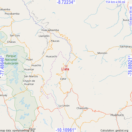
Llata GPS coordinates[2]
9° 25' 0.012" South, 76° 46' 59.988" West
| Map corner | latitude | longitude |
|---|---|---|
| Upper-left | -8.72234°, | -77.48646° |
| Center: | -9.41667°, | -76.78333° |
| Lower-right: | -10.10961°, | -76.08021° |
| Map W x H: | 154.2×154.3 km | = 95.8×95.9mi |
| max Lat: | -0.96667° ⇑35% North |
| Llata: | -9.41667° |
| min Lat: | ⇓65% South -18.01465° |
| min Long | Llata | max Long |
| -81.30472° | -76.78333° | -69.04167° |
| W 35.6%⇐ | ⇒64.4% E |
Elevation
Elevation of Llata is 2808 m = 9213 ft, and this is 489.3 m = 1605 ft above average elevation for this country.
| Max E: |
5022 m = 16476 ft | 50.9% |
| Llata | 2808 m 9213 ft | |
| Avg. | 2318.7 m = 7607 ft | |
Min E: |
1 m = 3 ft | 49.1% |
See also: Peru elevation on elevation.city.
Geographical zone
Llata is located in South Torrid zone (between Equator and Tropic of Capricorn). Distance of Equator is 1047 km =650.6 mi to North.| Distance of | km | miles | from Llata |
|---|---|---|---|
| Equator | 1047 | 650.6 | to North |
| Tropic Capricorn | 1558.9 | 968.7 | to South |
| Antarctic Circle | 6354.1 | 3948.3 | to South |
| South Pole | 8960 | 5567.5 | to South |


Nearby cities:
15 places around Llata: (largest is in red/bold)
• Anra
25.6 km =15.9 mi,  323°
323°
• Arancay
27.4 km =17 mi,  7°
7°
• Chuquis
30.2 km =18.8 mi,  163°
163°
• Huacachi
20.4 km =12.7 mi,  302°
302°
• Huacchis
24.1 km =15 mi,  358°
358°
• Jacas Grande
14.6 km =9.1 mi, 159°
• Llata
15.3 km =9.5 mi,  193°
193°
• Miraflores
9.4 km =5.8 mi,  204°
204°
• Punchao
6.4 km =4 mi,  218°
218°
• Puños
14.3 km =8.9 mi,  231°
231°
• Quivilla
21.3 km =13.2 mi, 162°
• Rapayan
23.9 km =14.9 mi, 6°
• Singa
4.6 km =2.9 mi, 315°
• Tantamayo
7.2 km =4.5 mi,  66°
66°
• Uco
29.9 km =18.6 mi,  328°
328°
Sources, notices
• [Note1] Compared only with cities in Peru existing in our database
• [Src1] Map data: © OpenStreetMap contributors (CC-BY-SA)
• [Src2] Other city data from geonames.org with taken over terms of usage.
• [Src3] Geographical zone / Annual Mean Temperature by Robert A. Rohde @ Wikipedia
