Arancay geodata
Arancay (Huanuco) is a seat of a third-order administrative division; located in Peru in America/Lima (GMT-5) time zone. In our database, there are 305 cities with bigger population. Compared to other cities in Peru, 67.6% of cities are located further ↓South; 63.5% of cities are located further →East and 57% of cities have lower elevation than Arancay. Note1


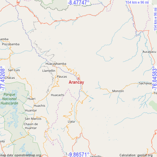
Arancay GPS coordinates[2]
9° 10' 20.172" South, 76° 44' 56.22" West
| Map corner | latitude | longitude |
|---|---|---|
| Upper-left | -8.47747°, | -77.45208° |
| Center: | -9.17227°, | -76.74895° |
| Lower-right: | -9.86571°, | -76.04583° |
| Map W x H: | 154.4×154.4 km | = 95.9×95.9mi |
| max Lat: | -0.96667° ⇑32.4% North |
| Arancay: | -9.17227° |
| min Lat: | ⇓67.6% South -18.01465° |
| min Long | Arancay | max Long |
| -81.30472° | -76.74895° | -69.04167° |
| W 36.5%⇐ | ⇒63.5% E |
Elevation
Elevation of Arancay is 3079 m = 10102 ft, and this is 760.3 m = 2494 ft above average elevation for this country.
| Max E: |
5022 m = 16476 ft | 43% |
| Arancay | 3079 m 10102 ft | |
| Avg. | 2318.7 m = 7607 ft | |
Min E: |
1 m = 3 ft | 57% |
See also: Peru elevation on elevation.city.
Geographical zone
Arancay is located in South Torrid zone (between Equator and Tropic of Capricorn). Distance of Equator is 1019.9 km =633.7 mi to North.| Distance of | km | miles | from Arancay |
|---|---|---|---|
| Equator | 1019.9 | 633.7 | to North |
| Tropic Capricorn | 1586.1 | 985.6 | to South |
| Antarctic Circle | 6381.3 | 3965.2 | to South |
| South Pole | 8987.2 | 5584.4 | to South |


Nearby cities:
15 places around Arancay: (largest is in red/bold)
• Aczo
26.5 km =16.5 mi,  274°
274°
• Anra
20.3 km =12.6 mi,  250°
250°
• Chingas
27.2 km =16.9 mi,  282°
282°
• Cochabamba
12.9 km =8 mi,  311°
311°
• Huacachi
26.4 km =16.4 mi,  232°
232°
• Huacaybamba
26.9 km =16.7 mi,  303°
303°
• Huacchis
5.3 km =3.3 mi, 233°
• Llata
27.4 km =17 mi,  187°
187°
• Miraflores
36.6 km =22.7 mi, 192°
• Paucas
16.6 km =10.3 mi, 277°
• Punchao
33.2 km =20.6 mi, 193°
• Rapayan
3.6 km =2.2 mi,  199°
199°
• Singa
24.9 km =15.5 mi, 196°
• Tantamayo
24.5 km =15.2 mi,  173°
173°
• Uco
19.7 km =12.2 mi,  264°
264°
Sources, notices
• [Note1] Compared only with cities in Peru existing in our database
• [Src1] Map data: © OpenStreetMap contributors (CC-BY-SA)
• [Src2] Other city data from geonames.org with taken over terms of usage.
• [Src3] Geographical zone / Annual Mean Temperature by Robert A. Rohde @ Wikipedia
