Shapaja geodata
Shapaja (San Martín) is a seat of a third-order administrative division; located in Peru in America/Lima (GMT-5) time zone. In our database, there are 305 cities with bigger population. Compared to other cities in Peru, 83.7% of cities are located further ↓South; 56% of cities are located further →East and 84.1% of cities have higher elevation than Shapaja. Note1


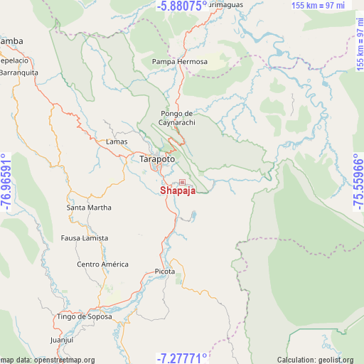
Shapaja GPS coordinates[2]
6° 34' 46.992" South, 76° 15' 46.008" West
| Map corner | latitude | longitude |
|---|---|---|
| Upper-left | -5.88075°, | -76.96591° |
| Center: | -6.57972°, | -76.26278° |
| Lower-right: | -7.27771°, | -75.55966° |
| Map W x H: | 155.3×155.3 km | = 96.5×96.5mi |
| max Lat: | -0.96667° ⇑16.3% North |
| Shapaja: | -6.57972° |
| min Lat: | ⇓83.7% South -18.01465° |
| min Long | Shapaja | max Long |
| -81.30472° | -76.26278° | -69.04167° |
| W 44%⇐ | ⇒56% E |
Elevation
Elevation of Shapaja is 207 m = 679 ft, and this is 2111.7 m = 6928 ft below average elevation for this country.
| Max E: |
5022 m = 16476 ft | 84.1% |
| Avg. | 2318.7 m = 7607 ft | |
| Shapaja | 207 m = 679 ft | |
Min E: |
1 m = 3 ft | 15.9% |
See also: Peru elevation on elevation.city.
Geographical zone
Shapaja is located in South Torrid zone (between Equator and Tropic of Capricorn). Distance of Equator is 731.6 km =454.6 mi to North.| Distance of | km | miles | from Shapaja |
|---|---|---|---|
| Equator | 731.6 | 454.6 | to North |
| Tropic Capricorn | 1874.3 | 1164.6 | to South |
| Antarctic Circle | 6669.6 | 4144.3 | to South |
| South Pole | 9275.5 | 5763.5 | to South |


Nearby cities:
15 places around Shapaja: (largest is in red/bold)
• Buenos Aires
24.5 km =15.2 mi,  196°
196°
• Chazuta
13.9 km =8.6 mi,  85°
85°
• Cuñumbuqui
25.2 km =15.7 mi,  287°
287°
• Juan Guerra
7.4 km =4.6 mi,  267°
267°
• Lamas
35 km =21.7 mi,  301°
301°
• Picota
38.6 km =24 mi,  191°
191°
• Pilluana
22.2 km =13.8 mi, 187°
• Pucacaca
31.5 km =19.6 mi, 196°
• San Antonio
25.6 km =15.9 mi,  337°
337°
• Santa Rosa
40.7 km =25.3 mi,  253°
253°
• Sauce
13.5 km =8.4 mi,  156°
156°
• Tarapoto
14.3 km =8.9 mi,  307°
307°
• Tres Unidos
25.5 km =15.8 mi,  171°
171°
• Utcurarca
9.6 km =6 mi, 195°
• Zapatero
26 km =16.2 mi,  282°
282°
Sources, notices
• [Note1] Compared only with cities in Peru existing in our database
• [Src1] Map data: © OpenStreetMap contributors (CC-BY-SA)
• [Src2] Other city data from geonames.org with taken over terms of usage.
• [Src3] Geographical zone / Annual Mean Temperature by Robert A. Rohde @ Wikipedia
