Pilluana geodata
Pilluana (San Martín) is a seat of a third-order administrative division; located in Peru in America/Lima (GMT-5) time zone. In our database, there are 305 cities with bigger population. Compared to other cities in Peru, 81.8% of cities are located further ↓South; 56.6% of cities are located further →East and 83.8% of cities have higher elevation than Pilluana. Note1


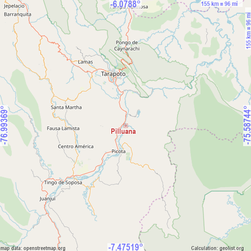
Pilluana GPS coordinates[2]
6° 46' 39" South, 76° 17' 26.016" West
| Map corner | latitude | longitude |
|---|---|---|
| Upper-left | -6.0788°, | -76.99369° |
| Center: | -6.7775°, | -76.29056° |
| Lower-right: | -7.47519°, | -75.58744° |
| Map W x H: | 155.3×155.3 km | = 96.5×96.5mi |
| max Lat: | -0.96667° ⇑18.2% North |
| Pilluana: | -6.7775° |
| min Lat: | ⇓81.8% South -18.01465° |
| min Long | Pilluana | max Long |
| -81.30472° | -76.29056° | -69.04167° |
| W 43.4%⇐ | ⇒56.6% E |
Elevation
Elevation of Pilluana is 213 m = 699 ft, and this is 2105.7 m = 6908 ft below average elevation for this country.
| Max E: |
5022 m = 16476 ft | 83.8% |
| Avg. | 2318.7 m = 7607 ft | |
| Pilluana | 213 m = 699 ft | |
Min E: |
1 m = 3 ft | 16.2% |
See also: Peru elevation on elevation.city.
Geographical zone
Pilluana is located in South Torrid zone (between Equator and Tropic of Capricorn). Distance of Equator is 753.6 km =468.3 mi to North.| Distance of | km | miles | from Pilluana |
|---|---|---|---|
| Equator | 753.6 | 468.3 | to North |
| Tropic Capricorn | 1852.3 | 1151 | to South |
| Antarctic Circle | 6647.6 | 4130.6 | to South |
| South Pole | 9253.5 | 5749.9 | to South |


Nearby cities:
15 places around Pilluana: (largest is in red/bold)
• Buenos Aires
4.2 km =2.6 mi,  249°
249°
• Caspisapa
24.4 km =15.2 mi,  215°
215°
• Chazuta
28.5 km =17.7 mi,  36°
36°
• Juan Guerra
22.1 km =13.7 mi,  348°
348°
• Picota
16.5 km =10.3 mi,  195°
195°
• Pucacaca
10 km =6.2 mi,  214°
214°
• Puerto Rico
27.8 km =17.3 mi, 210°
• San Pablo
31.8 km =19.8 mi,  261°
261°
• San Rafael
34.7 km =21.6 mi, 215°
• Sauce
12.7 km =7.9 mi, 41°
• Shamboyacu
32.4 km =20.1 mi,  147°
147°
• Shapaja
22.2 km =13.8 mi,  7°
7°
• Tarapoto
31.8 km =19.8 mi,  344°
344°
• Tres Unidos
7.5 km =4.7 mi,  115°
115°
• Utcurarca
12.7 km =7.9 mi,  1°
1°
Sources, notices
• [Note1] Compared only with cities in Peru existing in our database
• [Src1] Map data: © OpenStreetMap contributors (CC-BY-SA)
• [Src2] Other city data from geonames.org with taken over terms of usage.
• [Src3] Geographical zone / Annual Mean Temperature by Robert A. Rohde @ Wikipedia
