Pira geodata
Pira (Ancash) is a seat of a third-order administrative division; located in Peru in America/Lima (GMT-5) time zone. In our database, there are 305 cities with bigger population. Compared to other cities in Peru, 64.1% of cities are located further ↓South; 76.3% of cities are located further →East and 54.3% of cities have lower elevation than Pira. Note1


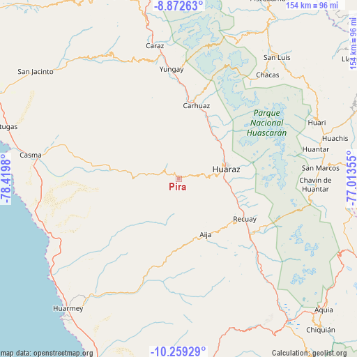
Pira GPS coordinates[2]
9° 34' 0.012" South, 77° 43' 0.012" West
| Map corner | latitude | longitude |
|---|---|---|
| Upper-left | -8.87263°, | -78.4198° |
| Center: | -9.56667°, | -77.71667° |
| Lower-right: | -10.25929°, | -77.01355° |
| Map W x H: | 154.2×154.2 km | = 95.8×95.8mi |
| max Lat: | -0.96667° ⇑35.9% North |
| Pira: | -9.56667° |
| min Lat: | ⇓64.1% South -18.01465° |
| min Long | Pira | max Long |
| -81.30472° | -77.71667° | -69.04167° |
| W 23.7%⇐ | ⇒76.3% E |
Elevation
Elevation of Pira is 3007 m = 9865 ft, and this is 688.3 m = 2258 ft above average elevation for this country.
| Max E: |
5022 m = 16476 ft | 45.7% |
| Pira | 3007 m 9865 ft | |
| Avg. | 2318.7 m = 7607 ft | |
Min E: |
1 m = 3 ft | 54.3% |
See also: Peru elevation on elevation.city.
Geographical zone
Pira is located in South Torrid zone (between Equator and Tropic of Capricorn). Distance of Equator is 1063.7 km =661 mi to North.| Distance of | km | miles | from Pira |
|---|---|---|---|
| Equator | 1063.7 | 661 | to North |
| Tropic Capricorn | 1542.2 | 958.3 | to South |
| Antarctic Circle | 6337.5 | 3937.9 | to South |
| South Pole | 8943.3 | 5557.1 | to South |


Nearby cities:
15 places around Pira: (largest is in red/bold)
• Aco
27.7 km =17.2 mi,  37°
37°
• Aija
26.6 km =16.5 mi,  153°
153°
• Anta
26.6 km =16.5 mi,  29°
29°
• Cajamarquilla
8.3 km =5.2 mi,  206°
206°
• Cochabamba
17.6 km =10.9 mi,  297°
297°
• Colcabamba
11.1 km =6.9 mi,  260°
260°
• Huanchay
22.5 km =14 mi, 214°
• Huaraz
21.2 km =13.2 mi,  78°
78°
• Jangas
23.9 km =14.9 mi, 40°
• La Merced
21.7 km =13.5 mi, 149°
• Marcara District
29.8 km =18.5 mi,  24°
24°
• Olleros
26.6 km =16.5 mi,  106°
106°
• Pampas
16.9 km =10.5 mi,  228°
228°
• Tarica
24.8 km =15.4 mi, 38°
• Yungar
25 km =15.5 mi, 32°
Sources, notices
• [Note1] Compared only with cities in Peru existing in our database
• [Src1] Map data: © OpenStreetMap contributors (CC-BY-SA)
• [Src2] Other city data from geonames.org with taken over terms of usage.
• [Src3] Geographical zone / Annual Mean Temperature by Robert A. Rohde @ Wikipedia
