Paucas geodata
Paucas (Ancash) is a seat of a third-order administrative division; located in Peru in America/Lima (GMT-5) time zone. In our database, there are 305 cities with bigger population. Compared to other cities in Peru, 67.8% of cities are located further ↓South; 66% of cities are located further →East and 74.4% of cities have lower elevation than Paucas. Note1


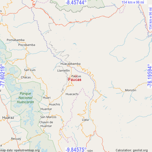
Paucas GPS coordinates[2]
9° 9' 8.172" South, 76° 53' 56.616" West
| Map corner | latitude | longitude |
|---|---|---|
| Upper-left | -8.45744°, | -77.60219° |
| Center: | -9.15227°, | -76.89906° |
| Lower-right: | -9.84575°, | -76.19594° |
| Map W x H: | 154.4×154.4 km | = 95.9×95.9mi |
| max Lat: | -0.96667° ⇑32.2% North |
| Paucas: | -9.15227° |
| min Lat: | ⇓67.8% South -18.01465° |
| min Long | Paucas | max Long |
| -81.30472° | -76.89906° | -69.04167° |
| W 34%⇐ | ⇒66% E |
Elevation
Elevation of Paucas is 3421 m = 11224 ft, and this is 1102.3 m = 3616 ft above average elevation for this country.
| Max E: |
5022 m = 16476 ft | 25.6% |
| Paucas | 3421 m 11224 ft | |
| Avg. | 2318.7 m = 7607 ft | |
Min E: |
1 m = 3 ft | 74.4% |
See also: Peru elevation on elevation.city.
Geographical zone
Paucas is located in South Torrid zone (between Equator and Tropic of Capricorn). Distance of Equator is 1017.6 km =632.3 mi to North.| Distance of | km | miles | from Paucas |
|---|---|---|---|
| Equator | 1017.6 | 632.3 | to North |
| Tropic Capricorn | 1588.3 | 986.9 | to South |
| Antarctic Circle | 6383.5 | 3966.5 | to South |
| South Pole | 8989.4 | 5585.8 | to South |


Nearby cities:
15 places around Paucas: (largest is in red/bold)
• Aczo
9.9 km =6.2 mi,  270°
270°
• Anra
9.4 km =5.8 mi,  196°
196°
• Arancay
16.6 km =10.3 mi,  97°
97°
• Chingas
10.8 km =6.7 mi,  289°
289°
• Cochabamba
9.3 km =5.8 mi,  47°
47°
• Huacachi
18.8 km =11.7 mi,  193°
193°
• Huacaybamba
14 km =8.7 mi,  335°
335°
• Huacchis
13.3 km =8.3 mi,  113°
113°
• Huachis
37.9 km =23.5 mi,  219°
219°
• Llata
32 km =19.9 mi,  156°
156°
• Punchao
35.5 km =22.1 mi,  165°
165°
• Rapayan
16.3 km =10.1 mi, 110°
• Singa
27.8 km =17.3 mi, 160°
• Tantamayo
32.8 km =20.4 mi,  144°
144°
• Uco
5.1 km =3.2 mi, 218°
Sources, notices
• [Note1] Compared only with cities in Peru existing in our database
• [Src1] Map data: © OpenStreetMap contributors (CC-BY-SA)
• [Src2] Other city data from geonames.org with taken over terms of usage.
• [Src3] Geographical zone / Annual Mean Temperature by Robert A. Rohde @ Wikipedia
