La Jalca geodata
La Jalca (Amazonas) is a seat of a third-order administrative division; located in Peru in America/Lima (GMT-5) time zone. In our database, there are 305 cities with bigger population. Compared to other cities in Peru, 85.1% of cities are located further ↓South; 77.8% of cities are located further →East and 50.2% of cities have higher elevation than La Jalca. Note1


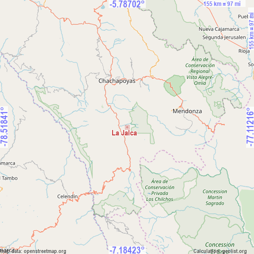
La Jalca GPS coordinates[2]
6° 29' 9.996" South, 77° 48' 55.008" West
| Map corner | latitude | longitude |
|---|---|---|
| Upper-left | -5.78702°, | -78.51841° |
| Center: | -6.48611°, | -77.81528° |
| Lower-right: | -7.18423°, | -77.11216° |
| Map W x H: | 155.4×155.4 km | = 96.6×96.6mi |
| max Lat: | -0.96667° ⇑14.9% North |
| La Jalca: | -6.48611° |
| min Lat: | ⇓85.1% South -18.01465° |
| min Long | La Jalca | max Long |
| -81.30472° | -77.81528° | -69.04167° |
| W 22.2%⇐ | ⇒77.8% E |
Elevation
Elevation of La Jalca is 2850 m = 9350 ft, and this is 531.3 m = 1743 ft above average elevation for this country.
| Max E: |
5022 m = 16476 ft | 50.2% |
| La Jalca | 2850 m 9350 ft | |
| Avg. | 2318.7 m = 7607 ft | |
Min E: |
1 m = 3 ft | 49.8% |
See also: Peru elevation on elevation.city.
Geographical zone
La Jalca is located in South Torrid zone (between Equator and Tropic of Capricorn). Distance of Equator is 721.2 km =448.1 mi to North.| Distance of | km | miles | from La Jalca |
|---|---|---|---|
| Equator | 721.2 | 448.1 | to North |
| Tropic Capricorn | 1884.7 | 1171.1 | to South |
| Antarctic Circle | 6680 | 4150.8 | to South |
| South Pole | 9285.9 | 5770 | to South |


Nearby cities:
15 places around La Jalca: (largest is in red/bold)
• Chachapoyas
28.9 km =18 mi,  348°
348°
• Cheto
28.5 km =17.7 mi,  26°
26°
• Cocabamba
25.6 km =15.9 mi,  240°
240°
• Cochamal
27.1 km =16.8 mi,  70°
70°
• Colcamar
26.9 km =16.7 mi,  319°
319°
• Daguas
30 km =18.6 mi,  15°
15°
• Duraznopampa
11.9 km =7.4 mi,  176°
176°
• Huambo
31.5 km =19.6 mi,  78°
78°
• Levanto
21.8 km =13.5 mi,  335°
335°
• Longuita
18.7 km =11.6 mi,  295°
295°
• Magdalena
15.7 km =9.8 mi, 323°
• Maino
18.1 km =11.2 mi, 336°
• Montevideo
14.5 km =9 mi,  174°
174°
• Soloco
26.1 km =16.2 mi, 17°
• Tingo
16.6 km =10.3 mi, 319°
Sources, notices
• [Note1] Compared only with cities in Peru existing in our database
• [Src1] Map data: © OpenStreetMap contributors (CC-BY-SA)
• [Src2] Other city data from geonames.org with taken over terms of usage.
• [Src3] Geographical zone / Annual Mean Temperature by Robert A. Rohde @ Wikipedia
