Huambo geodata
Huambo (Amazonas) is a seat of a third-order administrative division; located in Peru in America/Lima (GMT-5) time zone. In our database, there are 305 cities with bigger population. Compared to other cities in Peru, 85.5% of cities are located further ↓South; 73.3% of cities are located further →East and 68.2% of cities have higher elevation than Huambo. Note1
Administrative division(s):
- Level 1: Amazonas
- Level 2: Provincia de Rodríguez de Mendoza
- Level 3: Huambo


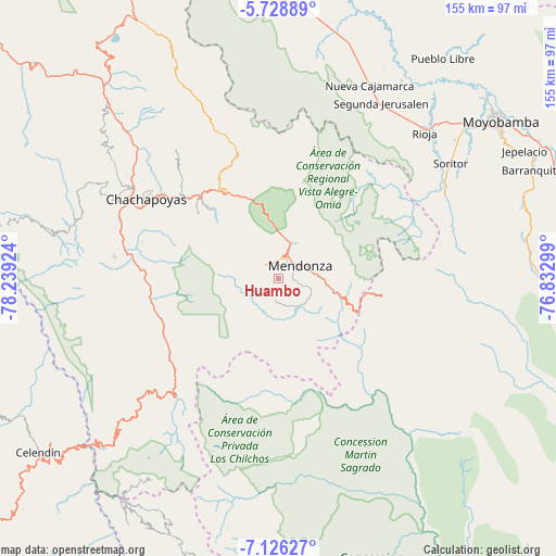
Huambo GPS coordinates[2]
6° 25' 41.016" South, 77° 32' 9.996" West
| Map corner | latitude | longitude |
|---|---|---|
| Upper-left | -5.72889°, | -78.23924° |
| Center: | -6.42806°, | -77.53611° |
| Lower-right: | -7.12627°, | -76.83299° |
| Map W x H: | 155.4×155.4 km | = 96.6×96.6mi |
| max Lat: | -0.96667° ⇑14.5% North |
| Huambo: | -6.42806° |
| min Lat: | ⇓85.5% South -18.01465° |
| min Long | Huambo | max Long |
| -81.30472° | -77.53611° | -69.04167° |
| W 26.7%⇐ | ⇒73.3% E |
Elevation
Elevation of Huambo is 1688 m = 5538 ft, and this is 630.7 m = 2069 ft below average elevation for this country.
| Max E: |
5022 m = 16476 ft | 68.2% |
| Avg. | 2318.7 m = 7607 ft | |
| Huambo | 1688 m = 5538 ft | |
Min E: |
1 m = 3 ft | 31.8% |
See also: Peru elevation on elevation.city.
Geographical zone
Huambo is located in South Torrid zone (between Equator and Tropic of Capricorn). Distance of Equator is 714.7 km =444.1 mi to North.| Distance of | km | miles | from Huambo |
|---|---|---|---|
| Equator | 714.7 | 444.1 | to North |
| Tropic Capricorn | 1891.2 | 1175.1 | to South |
| Antarctic Circle | 6686.4 | 4154.7 | to South |
| South Pole | 9292.3 | 5774 | to South |


Nearby cities:
15 places around Huambo: (largest is in red/bold)
• Cheto
26.3 km =16.3 mi,  316°
316°
• Cochamal
5.7 km =3.5 mi,  294°
294°
• Daguas
31.8 km =19.8 mi,  314°
314°
• Duraznopampa
35.2 km =21.9 mi,  238°
238°
• Granada
37.9 km =23.5 mi,  344°
344°
• La Jalca
31.5 km =19.6 mi,  258°
258°
• Longar
5.1 km =3.2 mi,  348°
348°
• Maino
39.3 km =24.4 mi,  284°
284°
• Mendoza
7.1 km =4.4 mi,  58°
58°
• Milpuc
13.3 km =8.3 mi,  123°
123°
• Montevideo
36.1 km =22.4 mi,  234°
234°
• Omia
16.3 km =10.1 mi,  106°
106°
• Soloco
29.5 km =18.3 mi, 308°
• Totora
10 km =6.2 mi,  135°
135°
• Vista Alegre
40.3 km =25 mi,  40°
40°
Sources, notices
• [Note1] Compared only with cities in Peru existing in our database
• [Src1] Map data: © OpenStreetMap contributors (CC-BY-SA)
• [Src2] Other city data from geonames.org with taken over terms of usage.
• [Src3] Geographical zone / Annual Mean Temperature by Robert A. Rohde @ Wikipedia
