Cochamal geodata
Cochamal (Amazonas) is a seat of a third-order administrative division; located in Peru in America/Lima (GMT-5) time zone. In our database, there are 305 cities with bigger population. Compared to other cities in Peru, 86% of cities are located further ↓South; 73.8% of cities are located further →East and 68.6% of cities have higher elevation than Cochamal. Note1
Administrative division(s):
- Level 1: Amazonas
- Level 2: Provincia de Rodríguez de Mendoza
- Level 3: Cochamal


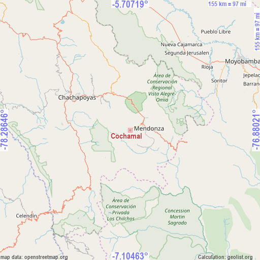
Cochamal GPS coordinates[2]
6° 24' 23.004" South, 77° 34' 59.988" West
| Map corner | latitude | longitude |
|---|---|---|
| Upper-left | -5.70719°, | -78.28646° |
| Center: | -6.40639°, | -77.58333° |
| Lower-right: | -7.10463°, | -76.88021° |
| Map W x H: | 155.4×155.4 km | = 96.6×96.6mi |
| max Lat: | -0.96667° ⇑14% North |
| Cochamal: | -6.40639° |
| min Lat: | ⇓86% South -18.01465° |
| min Long | Cochamal | max Long |
| -81.30472° | -77.58333° | -69.04167° |
| W 26.2%⇐ | ⇒73.8% E |
Elevation
Elevation of Cochamal is 1647 m = 5404 ft, and this is 671.7 m = 2204 ft below average elevation for this country.
| Max E: |
5022 m = 16476 ft | 68.6% |
| Avg. | 2318.7 m = 7607 ft | |
| Cochamal | 1647 m = 5404 ft | |
Min E: |
1 m = 3 ft | 31.4% |
See also: Peru elevation on elevation.city.
Geographical zone
Cochamal is located in South Torrid zone (between Equator and Tropic of Capricorn). Distance of Equator is 712.3 km =442.6 mi to North.| Distance of | km | miles | from Cochamal |
|---|---|---|---|
| Equator | 712.3 | 442.6 | to North |
| Tropic Capricorn | 1893.6 | 1176.6 | to South |
| Antarctic Circle | 6688.9 | 4156.3 | to South |
| South Pole | 9294.7 | 5775.5 | to South |


Nearby cities:
15 places around Cochamal: (largest is in red/bold)
• Cheto
21.1 km =13.1 mi,  322°
322°
• Daguas
26.5 km =16.5 mi, 318°
• Duraznopampa
32.4 km =20.1 mi,  230°
230°
• Granada
34.5 km =21.4 mi,  352°
352°
• Huambo
5.7 km =3.5 mi,  114°
114°
• La Jalca
27.1 km =16.8 mi,  250°
250°
• Longar
5 km =3.1 mi,  58°
58°
• Magdalena
35.2 km =21.9 mi,  276°
276°
• Maino
33.7 km =20.9 mi, 283°
• Mendoza
11.3 km =7 mi,  83°
83°
• Milpuc
19 km =11.8 mi,  120°
120°
• Montevideo
33.6 km =20.9 mi, 226°
• Omia
22 km =13.7 mi, 108°
• Soloco
24 km =14.9 mi,  311°
311°
• Totora
15.5 km =9.6 mi,  128°
128°
Sources, notices
• [Note1] Compared only with cities in Peru existing in our database
• [Src1] Map data: © OpenStreetMap contributors (CC-BY-SA)
• [Src2] Other city data from geonames.org with taken over terms of usage.
• [Src3] Geographical zone / Annual Mean Temperature by Robert A. Rohde @ Wikipedia
