Chisquilla geodata
Chisquilla (Amazonas) is a seat of a third-order administrative division; located in Peru in America/Lima (GMT-5) time zone. In our database, there are 305 cities with bigger population. Compared to other cities in Peru, 91.2% of cities are located further ↓South; 76.6% of cities are located further →East and 50.8% of cities have lower elevation than Chisquilla. Note1


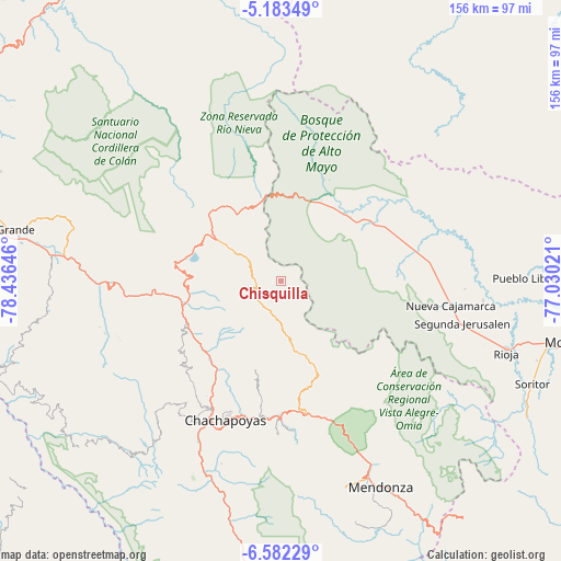
Chisquilla GPS coordinates[2]
5° 52' 59.988" South, 77° 43' 59.988" West
| Map corner | latitude | longitude |
|---|---|---|
| Upper-left | -5.18349°, | -78.43646° |
| Center: | -5.88333°, | -77.73333° |
| Lower-right: | -6.58229°, | -77.03021° |
| Map W x H: | 155.5×155.5 km | = 96.6×96.6mi |
| max Lat: | -0.96667° ⇑8.8% North |
| Chisquilla: | -5.88333° |
| min Lat: | ⇓91.2% South -18.01465° |
| min Long | Chisquilla | max Long |
| -81.30472° | -77.73333° | -69.04167° |
| W 23.4%⇐ | ⇒76.6% E |
Elevation
Elevation of Chisquilla is 2879 m = 9446 ft, and this is 560.3 m = 1838 ft above average elevation for this country.
| Max E: |
5022 m = 16476 ft | 49.2% |
| Chisquilla | 2879 m 9446 ft | |
| Avg. | 2318.7 m = 7607 ft | |
Min E: |
1 m = 3 ft | 50.8% |
See also: Peru elevation on elevation.city.
Geographical zone
Chisquilla is located in South Torrid zone (between Equator and Tropic of Capricorn). Distance of Equator is 654.2 km =406.5 mi to North.| Distance of | km | miles | from Chisquilla |
|---|---|---|---|
| Equator | 654.2 | 406.5 | to North |
| Tropic Capricorn | 1951.8 | 1212.8 | to South |
| Antarctic Circle | 6747 | 4192.4 | to South |
| South Pole | 9352.9 | 5811.6 | to South |


Nearby cities:
15 places around Chisquilla: (largest is in red/bold)
• Bajo Naranjillo
39.5 km =24.5 mi,  78°
78°
• Churuja
28.3 km =17.6 mi,  239°
239°
• Cuispes
22.4 km =13.9 mi,  260°
260°
• Daguas
38.2 km =23.7 mi,  181°
181°
• Granada
26.7 km =16.6 mi,  153°
153°
• Huancas
35.5 km =22.1 mi,  204°
204°
• Lamud
37.3 km =23.2 mi,  220°
220°
• Luya
39 km =24.2 mi, 216°
• Naranjos
30.4 km =18.9 mi,  59°
59°
• Olleros
20.8 km =12.9 mi, 152°
• Olto
34.9 km =21.7 mi,  225°
225°
• Paclas
33.5 km =20.8 mi, 233°
• Quinjalca
24 km =14.9 mi,  165°
165°
• San Carlos
24 km =14.9 mi,  247°
247°
• Yambrasbamba
23.7 km =14.7 mi,  308°
308°
Sources, notices
• [Note1] Compared only with cities in Peru existing in our database
• [Src1] Map data: © OpenStreetMap contributors (CC-BY-SA)
• [Src2] Other city data from geonames.org with taken over terms of usage.
• [Src3] Geographical zone / Annual Mean Temperature by Robert A. Rohde @ Wikipedia
