Chulucanas geodata
Chulucanas (Piura) is a seat of a third-order administrative division; located in Peru in America/Lima (GMT-5) time zone. With population of 68,835 people, there are 26 cities with bigger population in this country. Compared to other cities in Peru, 95% of cities are located further ↓South; 96.8% of cities are located further →East and 90% of cities have higher elevation than Chulucanas. Note1


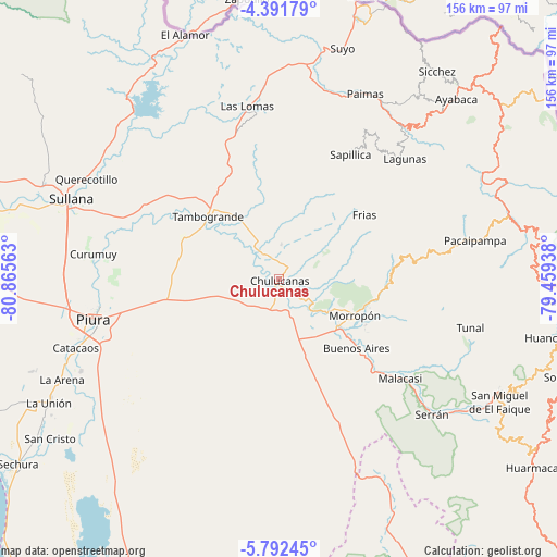
Chulucanas GPS coordinates[2]
5° 5' 33" South, 80° 9' 45" West
| Map corner | latitude | longitude |
|---|---|---|
| Upper-left | -4.39179°, | -80.86563° |
| Center: | -5.0925°, | -80.1625° |
| Lower-right: | -5.79245°, | -79.45938° |
| Map W x H: | 155.7×155.7 km | = 96.7×96.7mi |
| max Lat: | -0.96667° ⇑5% North |
| Chulucanas: | -5.0925° |
| min Lat: | ⇓95% South -18.01465° |
| min Long | Chulucanas | max Long |
| -81.30472° | -80.1625° | -69.04167° |
| W 3.2%⇐ | ⇒96.8% E |
Elevation
Elevation of Chulucanas is 92 m = 302 ft, and this is 2226.7 m = 7305 ft below average elevation for this country.
| Max E: |
5022 m = 16476 ft | 90% |
| Avg. | 2318.7 m = 7607 ft | |
| Chulucanas | 92 m = 302 ft | |
Min E: |
1 m = 3 ft | 10% |
See also: Chulucanas elevation on elevation.city.
Geographical zone
Chulucanas is located in South Torrid zone (between Equator and Tropic of Capricorn). Distance of Equator is 566.2 km =351.8 mi to North.| Distance of | km | miles | from Chulucanas |
|---|---|---|---|
| Equator | 566.2 | 351.8 | to North |
| Tropic Capricorn | 2039.7 | 1267.4 | to South |
| Antarctic Circle | 6834.9 | 4247 | to South |
| South Pole | 9440.8 | 5866.2 | to South |


Nearby cities:
15 places around Chulucanas: (largest is in red/bold)
• Buenos Aires
28.9 km =18 mi,  130°
130°
• Chalaco
41.3 km =25.7 mi,  81°
81°
• Frias
29.9 km =18.6 mi,  52°
52°
• Lagunas
48.8 km =30.3 mi, 46°
• Las Lomas
49.7 km =30.9 mi,  349°
349°
• Morropón
23.7 km =14.7 mi,  116°
116°
• Pacaipampa
55.9 km =34.7 mi, 78°
• Paimas
57.1 km =35.5 mi,  25°
25°
• Paltashaco
30.9 km =19.2 mi,  91°
91°
• Piura
53.3 km =33.1 mi,  257°
257°
• Santo Domingo
32.8 km =20.4 mi, 76°
• Sapillica
40.2 km =25 mi, 29°
• Tambo Grande
27.3 km =17 mi,  312°
312°
• Tunal
55.5 km =34.5 mi,  103°
103°
• Yamango
46.6 km =29 mi, 101°
Sources, notices
• [Note1] Compared only with cities in Peru existing in our database
• [Src1] Map data: © OpenStreetMap contributors (CC-BY-SA)
• [Src2] Other city data from geonames.org with taken over terms of usage.
• [Src3] Geographical zone / Annual Mean Temperature by Robert A. Rohde @ Wikipedia
