Caspisapa geodata
Caspisapa (San Martín) is a seat of a third-order administrative division; located in Peru in America/Lima (GMT-5) time zone. In our database, there are 305 cities with bigger population. Compared to other cities in Peru, 79.8% of cities are located further ↓South; 58.4% of cities are located further →East and 83.1% of cities have higher elevation than Caspisapa. Note1


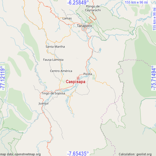
Caspisapa GPS coordinates[2]
6° 57' 24.984" South, 76° 25' 5.016" West
| Map corner | latitude | longitude |
|---|---|---|
| Upper-left | -6.25849°, | -77.12119° |
| Center: | -6.95694°, | -76.41806° |
| Lower-right: | -7.65435°, | -75.71494° |
| Map W x H: | 155.2×155.2 km | = 96.4×96.4mi |
| max Lat: | -0.96667° ⇑20.2% North |
| Caspisapa: | -6.95694° |
| min Lat: | ⇓79.8% South -18.01465° |
| min Long | Caspisapa | max Long |
| -81.30472° | -76.41806° | -69.04167° |
| W 41.6%⇐ | ⇒58.4% E |
Elevation
Elevation of Caspisapa is 232 m = 761 ft, and this is 2086.7 m = 6846 ft below average elevation for this country.
| Max E: |
5022 m = 16476 ft | 83.1% |
| Avg. | 2318.7 m = 7607 ft | |
| Caspisapa | 232 m = 761 ft | |
Min E: |
1 m = 3 ft | 16.9% |
See also: Peru elevation on elevation.city.
Geographical zone
Caspisapa is located in South Torrid zone (between Equator and Tropic of Capricorn). Distance of Equator is 773.5 km =480.6 mi to North.| Distance of | km | miles | from Caspisapa |
|---|---|---|---|
| Equator | 773.5 | 480.6 | to North |
| Tropic Capricorn | 1832.4 | 1138.6 | to South |
| Antarctic Circle | 6627.6 | 4118.2 | to South |
| South Pole | 9233.5 | 5737.4 | to South |


Nearby cities:
15 places around Caspisapa: (largest is in red/bold)
• Bellavista
22.1 km =13.7 mi,  239°
239°
• Buenos Aires
21 km =13 mi,  28°
28°
• Ledoy
31.9 km =19.8 mi,  233°
233°
• Picota
10.4 km =6.5 mi,  66°
66°
• Pilluana
24.4 km =15.2 mi,  35°
35°
• Pucacaca
14.4 km =8.9 mi, 35°
• Puerto Rico
3.9 km =2.4 mi,  181°
181°
• Sacanche
35.1 km =21.8 mi,  249°
249°
• San Pablo
23.2 km =14.4 mi,  311°
311°
• San Rafael
10.3 km =6.4 mi,  217°
217°
• Santa Rosa
37.5 km =23.3 mi,  324°
324°
• Sauce
37.1 km =23.1 mi, 37°
• Shamboyacu
32.3 km =20.1 mi,  103°
103°
• Tres Unidos
26.7 km =16.6 mi,  51°
51°
• Utcurarca
35.8 km =22.2 mi,  23°
23°
Sources, notices
• [Note1] Compared only with cities in Peru existing in our database
• [Src1] Map data: © OpenStreetMap contributors (CC-BY-SA)
• [Src2] Other city data from geonames.org with taken over terms of usage.
• [Src3] Geographical zone / Annual Mean Temperature by Robert A. Rohde @ Wikipedia
