Shamboyacu geodata
Shamboyacu (San Martín) is a seat of a third-order administrative division; located in Peru in America/Lima (GMT-5) time zone. In our database, there are 305 cities with bigger population. Compared to other cities in Peru, 79.3% of cities are located further ↓South; 53.9% of cities are located further →East and 80.9% of cities have higher elevation than Shamboyacu. Note1


Shamboyacu GPS coordinates[2]
7° 1' 23.088" South, 76° 7' 58.728" West
| Map corner | latitude | longitude |
|---|---|---|
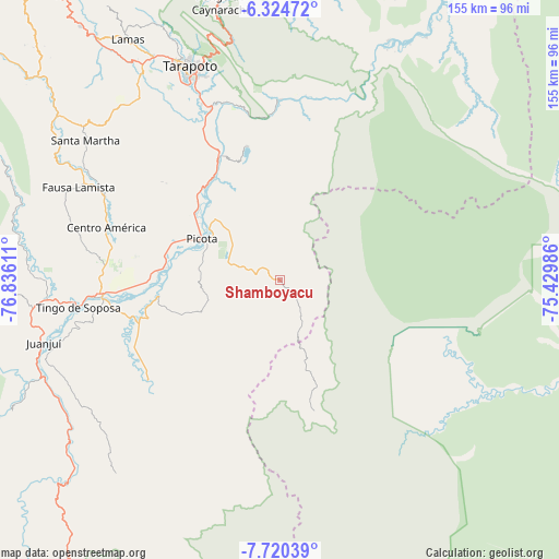
| Upper-left | -6.32472°, | -76.83611° |
| Center: | -7.02308°, | -76.13298° |
| Lower-right: | -7.72039°, | -75.42986° |
| Map W x H: | 155.2×155.2 km | = 96.4×96.4mi |
| max Lat: | -0.96667° ⇑20.7% North |
| Shamboyacu: | -7.02308° |
| min Lat: | ⇓79.3% South -18.01465° |
| min Long | Shamboyacu | max Long |
| -81.30472° | -76.13298° | -69.04167° |
| W 46.1%⇐ | ⇒53.9% E |
Elevation
Elevation of Shamboyacu is 302 m = 991 ft, and this is 2016.7 m = 6616 ft below average elevation for this country.
| Max E: |
5022 m = 16476 ft | 80.9% |
| Avg. | 2318.7 m = 7607 ft | |
| Shamboyacu | 302 m = 991 ft | |
Min E: |
1 m = 3 ft | 19.1% |
See also: Peru elevation on elevation.city.
Geographical zone
Shamboyacu is located in South Torrid zone (between Equator and Tropic of Capricorn). Distance of Equator is 780.9 km =485.2 mi to North.| Distance of | km | miles | from Shamboyacu |
|---|---|---|---|
| Equator | 780.9 | 485.2 | to North |
| Tropic Capricorn | 1825 | 1134 | to South |
| Antarctic Circle | 6620.3 | 4113.7 | to South |
| South Pole | 9226.2 | 5732.9 | to South |


Nearby cities:
15 places around Shamboyacu: (largest is in red/bold)
• Bellavista
50.7 km =31.5 mi,  265°
265°
• Buenos Aires
33.5 km =20.8 mi,  320°
320°
• Caspisapa
32.3 km =20.1 mi,  283°
283°
• Chazuta
50.3 km =31.3 mi,  359°
359°
• Juan Guerra
53.6 km =33.3 mi,  336°
336°
• Picota
24.7 km =15.3 mi,  297°
297°
• Pilluana
32.4 km =20.1 mi,  327°
327°
• Pucacaca
29.9 km =18.6 mi,  309°
309°
• Puerto Rico
31.8 km =19.8 mi, 276°
• San Pablo
53.9 km =33.5 mi,  294°
294°
• San Rafael
37.8 km =23.5 mi, 268°
• Sauce
38 km =23.6 mi,  346°
346°
• Shapaja
51.3 km =31.9 mi, 343°
• Tres Unidos
26.3 km =16.3 mi, 336°
• Utcurarca
43.5 km =27 mi, 337°
Sources, notices
• [Note1] Compared only with cities in Peru existing in our database
• [Src1] Map data: © OpenStreetMap contributors (CC-BY-SA)
• [Src2] Other city data from geonames.org with taken over terms of usage.
• [Src3] Geographical zone / Annual Mean Temperature by Robert A. Rohde @ Wikipedia
