Yunga geodata
Yunga (Moquegua) is a seat of a third-order administrative division; located in Peru in America/Lima (GMT-5) time zone. In our database, there are 305 cities with bigger population. Compared to other cities in Peru, 94.3% of cities are located further ↑North; 91.6% of cities are located further ←West and 87.5% of cities have lower elevation than Yunga. Note1
Administrative division(s):
- Level 1: Moquegua
- Level 2: Provincia de General Sánchez Cerro
- Level 3: Yunga


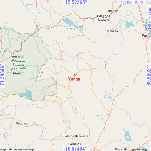
Yunga GPS coordinates[2]
16° 12' 0" South, 70° 40' 59.988" West
| Map corner | latitude | longitude |
|---|---|---|
| Upper-left | -15.52365°, | -71.38646° |
| Center: | -16.2°, | -70.68333° |
| Lower-right: | -16.87404°, | -69.98021° |
| Map W x H: | 150.1×150.2 km | = 93.3×93.3mi |
| max Lat: | -0.96667° ⇑94.3% North |
| Yunga: | -16.2° |
| min Lat: | ⇓5.7% South -18.01465° |
| min Long | Yunga | max Long |
| -81.30472° | -70.68333° | -69.04167° |
| W 91.6%⇐ | ⇒8.4% E |
Elevation
Elevation of Yunga is 3780 m = 12402 ft, and this is 1461.3 m = 4794 ft above average elevation for this country.
| Max E: |
5022 m = 16476 ft | 12.5% |
| Yunga | 3780 m 12402 ft | |
| Avg. | 2318.7 m = 7607 ft | |
Min E: |
1 m = 3 ft | 87.5% |
See also: Peru elevation on elevation.city.
Geographical zone
Yunga is located in South Torrid zone (between Equator and Tropic of Capricorn). Distance of this Southern Tropic circle is 804.6 km =500 mi to South.| Distance of | km | miles | from Yunga |
|---|---|---|---|
| Equator | 1801.3 | 1119.3 | to North |
| Tropic Capricorn | 804.6 | 500 | to South |
| Antarctic Circle | 5599.9 | 3479.6 | to South |
| South Pole | 8205.8 | 5098.8 | to South |


Nearby cities:
15 places around Yunga: (largest is in red/bold)
• Calacoa
61.2 km =38 mi,  181°
181°
• Chojata
22.9 km =14.2 mi,  193°
193°
• Coalaque
61.7 km =38.3 mi,  215°
215°
• Cuchumbaya
61.2 km =38 mi, 180°
• Hacienda Huancane
47.1 km =29.3 mi,  332°
332°
• Ichuña
13.6 km =8.5 mi,  65°
65°
• Lloque
15.8 km =9.8 mi,  199°
199°
• Matalaque
34.6 km =21.5 mi, 204°
• Mañazo
58.1 km =36.1 mi,  40°
40°
• Omate
62.5 km =38.8 mi,  210°
210°
• Quinistaquillas
64.8 km =40.3 mi, 199°
• Santa Lucía
56.4 km =35 mi,  8°
8°
• Tarucani
41 km =25.5 mi,  272°
272°
• Ubinas
29.6 km =18.4 mi, 221°
• Vilque
66.8 km =41.5 mi, 43°
Sources, notices
• [Note1] Compared only with cities in Peru existing in our database
• [Src1] Map data: © OpenStreetMap contributors (CC-BY-SA)
• [Src2] Other city data from geonames.org with taken over terms of usage.
• [Src3] Geographical zone / Annual Mean Temperature by Robert A. Rohde @ Wikipedia
