Hacienda Huancane geodata
Hacienda Huancane (Puno) is a populated place; located in Peru in America/Lima (GMT-5) time zone. With population of 7,831 people, there are 174 cities with bigger population in this country. Compared to other cities in Peru, 93% of cities are located further ↑North; 90.5% of cities are located further ←West and 99.4% of cities have lower elevation than Hacienda Huancane. Note1


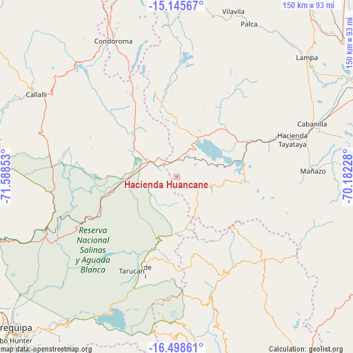
Hacienda Huancane GPS coordinates[2]
15° 49' 23.772" South, 70° 53' 7.44" West
| Map corner | latitude | longitude |
|---|---|---|
| Upper-left | -15.14567°, | -71.58853° |
| Center: | -15.82327°, | -70.8854° |
| Lower-right: | -16.49861°, | -70.18228° |
| Map W x H: | 150.4×150.4 km | = 93.5×93.5mi |
| max Lat: | -0.96667° ⇑93% North |
| Hacienda Huancane: | -15.82327° |
| min Lat: | ⇓7% South -18.01465° |
| min Long | Hacienda Huanca | max Long |
| -81.30472° | -70.8854° | -69.04167° |
| W 90.5%⇐ | ⇒9.5% E |
Elevation
Elevation of Hacienda Huancane is 4531 m = 14865 ft, and this is 2212.3 m = 7258 ft above average elevation for this country.
| Max E: |
5022 m = 16476 ft | 0.59999999999999% |
| Hacienda Huancane | 4531 m 14865 ft | |
| Avg. | 2318.7 m = 7607 ft | |
Min E: |
1 m = 3 ft | 99.4% |
See also: Peru elevation on elevation.city.
Geographical zone
Hacienda Huancane is located in South Torrid zone (between Equator and Tropic of Capricorn). Distance of this Southern Tropic circle is 846.5 km =526 mi to South.| Distance of | km | miles | from Hacienda Huancane |
|---|---|---|---|
| Equator | 1759.4 | 1093.2 | to North |
| Tropic Capricorn | 846.5 | 526 | to South |
| Antarctic Circle | 5641.8 | 3505.7 | to South |
| South Pole | 8247.7 | 5124.9 | to South |


Nearby cities:
15 places around Hacienda Huancane: (largest is in red/bold)
• Cabana
63.8 km =39.6 mi,  72°
72°
• Cabanilla
61.7 km =38.3 mi, 68°
• Huarancante
61.7 km =38.3 mi,  275°
275°
• Huarichancara
27.8 km =17.3 mi,  317°
317°
• Ichuña
49.8 km =30.9 mi,  136°
136°
• Jatun Orcochiri
50 km =31.1 mi, 279°
• Jayune
53.3 km =33.1 mi,  302°
302°
• Llongasora
48.8 km =30.3 mi,  294°
294°
• Lloque
59 km =36.7 mi,  164°
164°
• Mañazo
59.1 km =36.7 mi,  87°
87°
• Paratia
51.4 km =31.9 mi,  36°
36°
• Santa Lucía
33 km =20.5 mi,  64°
64°
• Tarucani
44.5 km =27.7 mi,  205°
205°
• Vizcachane
33.8 km =21 mi,  272°
272°
• Yunga
47.1 km =29.3 mi,  152°
152°
Sources, notices
• [Note1] Compared only with cities in Peru existing in our database
• [Src1] Map data: © OpenStreetMap contributors (CC-BY-SA)
• [Src2] Other city data from geonames.org with taken over terms of usage.
• [Src3] Geographical zone / Annual Mean Temperature by Robert A. Rohde @ Wikipedia
