Chojata geodata
Chojata (Moquegua) is a seat of a third-order administrative division; located in Peru in America/Lima (GMT-5) time zone. In our database, there are 305 cities with bigger population. Compared to other cities in Peru, 95.1% of cities are located further ↑North; 91.3% of cities are located further ←West and 96.6% of cities have lower elevation than Chojata. Note1
Administrative division(s):
- Level 1: Moquegua
- Level 2: Provincia de General Sánchez Cerro
- Level 3: Chojata


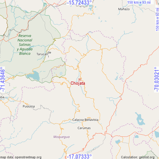
Chojata GPS coordinates[2]
16° 24' 0" South, 70° 43' 59.988" West
| Map corner | latitude | longitude |
|---|---|---|
| Upper-left | -15.72433°, | -71.43646° |
| Center: | -16.4°, | -70.73333° |
| Lower-right: | -17.07333°, | -70.03021° |
| Map W x H: | 150×150 km | = 93.2×93.2mi |
| max Lat: | -0.96667° ⇑95.1% North |
| Chojata: | -16.4° |
| min Lat: | ⇓4.9% South -18.01465° |
| min Long | Chojata | max Long |
| -81.30472° | -70.73333° | -69.04167° |
| W 91.3%⇐ | ⇒8.7% E |
Elevation
Elevation of Chojata is 4165 m = 13665 ft, and this is 1846.3 m = 6057 ft above average elevation for this country.
| Max E: |
5022 m = 16476 ft | 3.4% |
| Chojata | 4165 m 13665 ft | |
| Avg. | 2318.7 m = 7607 ft | |
Min E: |
1 m = 3 ft | 96.6% |
See also: Peru elevation on elevation.city.
Geographical zone
Chojata is located in South Torrid zone (between Equator and Tropic of Capricorn). Distance of this Southern Tropic circle is 782.4 km =486.2 mi to South.| Distance of | km | miles | from Chojata |
|---|---|---|---|
| Equator | 1823.5 | 1133.1 | to North |
| Tropic Capricorn | 782.4 | 486.2 | to South |
| Antarctic Circle | 5577.7 | 3465.8 | to South |
| South Pole | 8183.6 | 5085.1 | to South |


Nearby cities:
15 places around Chojata: (largest is in red/bold)
• Calacoa
39.1 km =24.3 mi,  174°
174°
• Carumas
46.4 km =28.8 mi,  177°
177°
• Coalaque
41.5 km =25.8 mi,  227°
227°
• Cuchumbaya
39.3 km =24.4 mi, 172°
• Hacienda Huancane
66.2 km =41.1 mi,  345°
345°
• Ichuña
33 km =20.5 mi,  32°
32°
• La Capilla
61.9 km =38.5 mi, 230°
• Lloque
7.4 km =4.6 mi,  0°
0°
• Matalaque
12.8 km =8 mi,  223°
223°
• Omate
41.3 km =25.7 mi, 220°
• Puquina
54.1 km =33.6 mi,  242°
242°
• Quinistaquillas
42.1 km =26.2 mi,  202°
202°
• Tarucani
43 km =26.7 mi,  304°
304°
• Ubinas
14.2 km =8.8 mi,  270°
270°
• Yunga
22.9 km =14.2 mi,  13°
13°
Sources, notices
• [Note1] Compared only with cities in Peru existing in our database
• [Src1] Map data: © OpenStreetMap contributors (CC-BY-SA)
• [Src2] Other city data from geonames.org with taken over terms of usage.
• [Src3] Geographical zone / Annual Mean Temperature by Robert A. Rohde @ Wikipedia
