Matalaque geodata
Matalaque (Moquegua) is a seat of a third-order administrative division; located in Peru in America/Lima (GMT-5) time zone. In our database, there are 305 cities with bigger population. Compared to other cities in Peru, 95.7% of cities are located further ↑North; 90.9% of cities are located further ←West and 52.3% of cities have higher elevation than Matalaque. Note1
Administrative division(s):
- Level 1: Moquegua
- Level 2: Provincia de General Sánchez Cerro
- Level 3: Matalaque


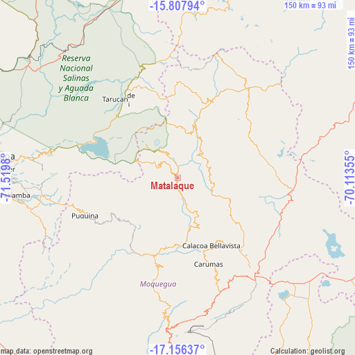
Matalaque GPS coordinates[2]
16° 28' 59.988" South, 70° 49' 0.012" West
| Map corner | latitude | longitude |
|---|---|---|
| Upper-left | -15.80794°, | -71.5198° |
| Center: | -16.48333°, | -70.81667° |
| Lower-right: | -17.15637°, | -70.11355° |
| Map W x H: | 149.9×149.9 km | = 93.1×93.1mi |
| max Lat: | -0.96667° ⇑95.7% North |
| Matalaque: | -16.48333° |
| min Lat: | ⇓4.3% South -18.01465° |
| min Long | Matalaque | max Long |
| -81.30472° | -70.81667° | -69.04167° |
| W 90.9%⇐ | ⇒9.1% E |
Elevation
Elevation of Matalaque is 2761 m = 9058 ft, and this is 442.3 m = 1451 ft above average elevation for this country.
| Max E: |
5022 m = 16476 ft | 52.3% |
| Matalaque | 2761 m 9058 ft | |
| Avg. | 2318.7 m = 7607 ft | |
Min E: |
1 m = 3 ft | 47.7% |
See also: Peru elevation on elevation.city.
Geographical zone
Matalaque is located in South Torrid zone (between Equator and Tropic of Capricorn). Distance of this Southern Tropic circle is 773.1 km =480.4 mi to South.| Distance of | km | miles | from Matalaque |
|---|---|---|---|
| Equator | 1832.8 | 1138.8 | to North |
| Tropic Capricorn | 773.1 | 480.4 | to South |
| Antarctic Circle | 5568.4 | 3460 | to South |
| South Pole | 8174.3 | 5079.3 | to South |


Nearby cities:
15 places around Matalaque: (largest is in red/bold)
• Calacoa
32.2 km =20 mi,  157°
157°
• Carumas
38.6 km =24 mi, 163°
• Chojata
12.8 km =8 mi,  43°
43°
• Coalaque
28.7 km =17.8 mi,  229°
229°
• Cuchumbaya
32.9 km =20.4 mi,  154°
154°
• Ichuña
45.7 km =28.4 mi, 35°
• La Capilla
49.2 km =30.6 mi, 231°
• Lloque
18.9 km =11.7 mi,  28°
28°
• Omate
28.5 km =17.7 mi,  218°
218°
• Pocsi
61.1 km =38 mi,  266°
266°
• Puquina
42.2 km =26.2 mi,  248°
248°
• Quinistaquillas
30.5 km =19 mi,  193°
193°
• Tarucani
42.7 km =26.5 mi,  321°
321°
• Ubinas
10.7 km =6.6 mi,  330°
330°
• Yunga
34.6 km =21.5 mi,  24°
24°
Sources, notices
• [Note1] Compared only with cities in Peru existing in our database
• [Src1] Map data: © OpenStreetMap contributors (CC-BY-SA)
• [Src2] Other city data from geonames.org with taken over terms of usage.
• [Src3] Geographical zone / Annual Mean Temperature by Robert A. Rohde @ Wikipedia
