Vitarte geodata
Vitarte (Lima region) is a seat of a third-order administrative division; located in Peru in America/Lima (GMT-5) time zone. In our database, there are 305 cities with bigger population. Compared to other cities in Peru, 53.5% of cities are located further ↑North; 66.5% of cities are located further →East and 80.1% of cities have higher elevation than Vitarte. Note1


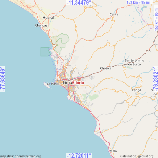
Vitarte GPS coordinates[2]
12° 1' 59.988" South, 76° 55' 59.988" West
| Map corner | latitude | longitude |
|---|---|---|
| Upper-left | -11.34479°, | -77.63646° |
| Center: | -12.03333°, | -76.93333° |
| Lower-right: | -12.72011°, | -76.23021° |
| Map W x H: | 152.9×152.9 km | = 95×95mi |
| max Lat: | -0.96667° ⇑53.5% North |
| Vitarte: | -12.03333° |
| min Lat: | ⇓46.5% South -18.01465° |
| min Long | Vitarte | max Long |
| -81.30472° | -76.93333° | -69.04167° |
| W 33.5%⇐ | ⇒66.5% E |
Elevation
Elevation of Vitarte is 330 m = 1083 ft, and this is 1988.7 m = 6525 ft below average elevation for this country.
| Max E: |
5022 m = 16476 ft | 80.1% |
| Avg. | 2318.7 m = 7607 ft | |
| Vitarte | 330 m = 1083 ft | |
Min E: |
1 m = 3 ft | 19.9% |
See also: Peru elevation on elevation.city.
Geographical zone
Vitarte is located in South Torrid zone (between Equator and Tropic of Capricorn). Distance of this Southern Tropic circle is 1267.9 km =787.8 mi to South.| Distance of | km | miles | from Vitarte |
|---|---|---|---|
| Equator | 1338 | 831.4 | to North |
| Tropic Capricorn | 1267.9 | 787.8 | to South |
| Antarctic Circle | 6063.2 | 3767.5 | to South |
| South Pole | 8669.1 | 5386.7 | to South |


Nearby cities:
15 places around Vitarte: (largest is in red/bold)
• Asentamiento Humano Nicolas de Pierola
27 km =16.8 mi,  66°
66°
• Callao
20.3 km =12.6 mi,  262°
262°
• Carabayllo
23 km =14.3 mi,  330°
330°
• Chaclacayo
18.9 km =11.7 mi, 72°
• Chosica
26.3 km =16.3 mi, 67°
• Cieneguilla
16.9 km =10.5 mi,  131°
131°
• Independencia
13.1 km =8.1 mi,  291°
291°
• La Molina
5.8 km =3.6 mi,  198°
198°
• Lima
10.4 km =6.5 mi, 263°
• San Isidro
15.7 km =9.8 mi,  233°
233°
• San Luis
8.2 km =5.1 mi, 233°
• Santa María
5.3 km =3.3 mi,  54°
54°
• Santiago de Surco
14 km =8.7 mi,  215°
215°
• Urb. Santo Domingo
20.6 km =12.8 mi, 328°
• Ventanilla
26.7 km =16.6 mi,  311°
311°
Sources, notices
• [Note1] Compared only with cities in Peru existing in our database
• [Src1] Map data: © OpenStreetMap contributors (CC-BY-SA)
• [Src2] Other city data from geonames.org with taken over terms of usage.
• [Src3] Geographical zone / Annual Mean Temperature by Robert A. Rohde @ Wikipedia
