Vinchos geodata
Vinchos (Ayacucho) is a seat of a third-order administrative division; located in Peru in America/Lima (GMT-5) time zone. In our database, there are 305 cities with bigger population. Compared to other cities in Peru, 63.6% of cities are located further ↑North; 62.9% of cities are located further ←West and 59.3% of cities have lower elevation than Vinchos. Note1


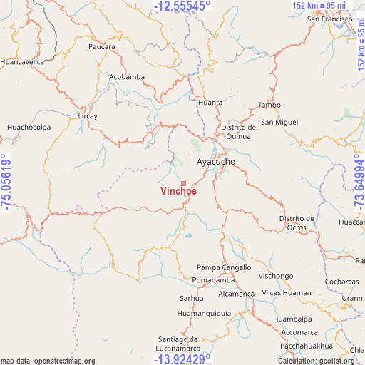
Vinchos GPS coordinates[2]
13° 14' 26.988" South, 74° 21' 11.016" West
| Map corner | latitude | longitude |
|---|---|---|
| Upper-left | -12.55545°, | -75.05619° |
| Center: | -13.24083°, | -74.35306° |
| Lower-right: | -13.92429°, | -73.64994° |
| Map W x H: | 152.2×152.2 km | = 94.6×94.6mi |
| max Lat: | -0.96667° ⇑63.6% North |
| Vinchos: | -13.24083° |
| min Lat: | ⇓36.4% South -18.01465° |
| min Long | Vinchos | max Long |
| -81.30472° | -74.35306° | -69.04167° |
| W 62.9%⇐ | ⇒37.1% E |
Elevation
Elevation of Vinchos is 3135 m = 10285 ft, and this is 816.3 m = 2678 ft above average elevation for this country.
| Max E: |
5022 m = 16476 ft | 40.7% |
| Vinchos | 3135 m 10285 ft | |
| Avg. | 2318.7 m = 7607 ft | |
Min E: |
1 m = 3 ft | 59.3% |
See also: Peru elevation on elevation.city.
Geographical zone
Vinchos is located in South Torrid zone (between Equator and Tropic of Capricorn). Distance of this Southern Tropic circle is 1133.7 km =704.4 mi to South.| Distance of | km | miles | from Vinchos |
|---|---|---|---|
| Equator | 1472.2 | 914.8 | to North |
| Tropic Capricorn | 1133.7 | 704.4 | to South |
| Antarctic Circle | 5928.9 | 3684 | to South |
| South Pole | 8534.8 | 5303.3 | to South |


Nearby cities:
15 places around Vinchos: (largest is in red/bold)
• Acocro
33.6 km =20.9 mi,  85°
85°
• Antaparco
19.7 km =12.2 mi,  341°
341°
• Ayacucho
16.8 km =10.4 mi,  57°
57°
• Carmen Alto
15.3 km =9.5 mi, 64°
• Chiara
16.4 km =10.2 mi,  102°
102°
• Chincho
30.5 km =19 mi,  357°
357°
• Huamanguilla
31.8 km =19.8 mi,  36°
36°
• Huanta
36 km =22.4 mi,  18°
18°
• Julcamarca
27.1 km =16.8 mi, 339°
• Macachacra
33.1 km =20.6 mi,  30°
30°
• Pacaycasa
25.4 km =15.8 mi, 36°
• Quinua
31.5 km =19.6 mi,  47°
47°
• Socos
7.5 km =4.7 mi,  67°
67°
• Tambillo
26.7 km =16.6 mi,  78°
78°
• Ticllas
12.2 km =7.6 mi,  10°
10°
Sources, notices
• [Note1] Compared only with cities in Peru existing in our database
• [Src1] Map data: © OpenStreetMap contributors (CC-BY-SA)
• [Src2] Other city data from geonames.org with taken over terms of usage.
• [Src3] Geographical zone / Annual Mean Temperature by Robert A. Rohde @ Wikipedia
