Tamburco geodata
Tamburco (Apurímac) is a seat of a third-order administrative division; located in Peru in America/Lima (GMT-5) time zone. In our database, there are 305 cities with bigger population. Compared to other cities in Peru, 68.7% of cities are located further ↑North; 74.8% of cities are located further ←West and 55.5% of cities have higher elevation than Tamburco. Note1


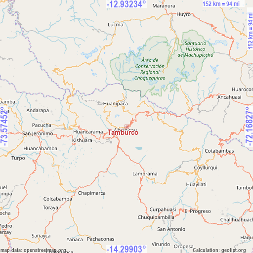
Tamburco GPS coordinates[2]
13° 37' 0.012" South, 72° 52' 17.004" West
| Map corner | latitude | longitude |
|---|---|---|
| Upper-left | -12.93234°, | -73.57452° |
| Center: | -13.61667°, | -72.87139° |
| Lower-right: | -14.29903°, | -72.16827° |
| Map W x H: | 152×152 km | = 94.4×94.4mi |
| max Lat: | -0.96667° ⇑68.7% North |
| Tamburco: | -13.61667° |
| min Lat: | ⇓31.3% South -18.01465° |
| min Long | Tamburco | max Long |
| -81.30472° | -72.87139° | -69.04167° |
| W 74.8%⇐ | ⇒25.2% E |
Elevation
Elevation of Tamburco is 2664 m = 8740 ft, and this is 345.3 m = 1133 ft above average elevation for this country.
| Max E: |
5022 m = 16476 ft | 55.5% |
| Tamburco | 2664 m 8740 ft | |
| Avg. | 2318.7 m = 7607 ft | |
Min E: |
1 m = 3 ft | 44.5% |
See also: Peru elevation on elevation.city.
Geographical zone
Tamburco is located in South Torrid zone (between Equator and Tropic of Capricorn). Distance of this Southern Tropic circle is 1091.9 km =678.5 mi to South.| Distance of | km | miles | from Tamburco |
|---|---|---|---|
| Equator | 1514 | 940.8 | to North |
| Tropic Capricorn | 1091.9 | 678.5 | to South |
| Antarctic Circle | 5887.1 | 3658.1 | to South |
| South Pole | 8493 | 5277.3 | to South |


Nearby cities:
15 places around Tamburco: (largest is in red/bold)
• Abancay
2.2 km =1.4 mi,  209°
209°
• Cachora
13.3 km =8.3 mi,  30°
30°
• Chapimarca
45 km =28 mi, 207°
• Circa
28.6 km =17.8 mi,  180°
180°
• Curahuasi
20 km =12.4 mi,  68°
68°
• Huancarama
23.4 km =14.5 mi,  262°
262°
• Huanipaca
14.6 km =9.1 mi,  332°
332°
• Kishuara
27.8 km =17.3 mi,  251°
251°
• Lambrama
30 km =18.6 mi,  157°
157°
• Limatambo
48.8 km =30.3 mi, 71°
• Pacobamba
23.2 km =14.4 mi,  270°
270°
• Palpacachi
48.7 km =30.3 mi,  125°
125°
• Pichirhua
34.8 km =21.6 mi,  218°
218°
• San Pedro De Cachora
2.3 km =1.4 mi, 214°
• Tintay
51 km =31.7 mi, 221°
Sources, notices
• [Note1] Compared only with cities in Peru existing in our database
• [Src1] Map data: © OpenStreetMap contributors (CC-BY-SA)
• [Src2] Other city data from geonames.org with taken over terms of usage.
• [Src3] Geographical zone / Annual Mean Temperature by Robert A. Rohde @ Wikipedia
