San Pedro geodata
San Pedro (Ayacucho) is a seat of a third-order administrative division; located in Peru in America/Lima (GMT-5) time zone. In our database, there are 305 cities with bigger population. Compared to other cities in Peru, 84% of cities are located further ↑North; 65.2% of cities are located further ←West and 58% of cities have lower elevation than San Pedro. Note1


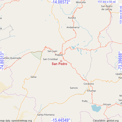
San Pedro GPS coordinates[2]
14° 46' 0.012" South, 74° 6' 0" West
| Map corner | latitude | longitude |
|---|---|---|
| Upper-left | -14.08572°, | -74.80313° |
| Center: | -14.76667°, | -74.1° |
| Lower-right: | -15.44549°, | -73.39688° |
| Map W x H: | 151.2×151.2 km | = 94×94mi |
| max Lat: | -0.96667° ⇑84% North |
| San Pedro: | -14.76667° |
| min Lat: | ⇓16% South -18.01465° |
| min Long | San Pedro | max Long |
| -81.30472° | -74.1° | -69.04167° |
| W 65.2%⇐ | ⇒34.8% E |
Elevation
Elevation of San Pedro is 3105 m = 10187 ft, and this is 786.3 m = 2580 ft above average elevation for this country.
| Max E: |
5022 m = 16476 ft | 42% |
| San Pedro | 3105 m 10187 ft | |
| Avg. | 2318.7 m = 7607 ft | |
Min E: |
1 m = 3 ft | 58% |
See also: Peru elevation on elevation.city.
Geographical zone
San Pedro is located in South Torrid zone (between Equator and Tropic of Capricorn). Distance of this Southern Tropic circle is 964 km =599 mi to South.| Distance of | km | miles | from San Pedro |
|---|---|---|---|
| Equator | 1641.9 | 1020.2 | to North |
| Tropic Capricorn | 964 | 599 | to South |
| Antarctic Circle | 5759.3 | 3578.7 | to South |
| South Pole | 8365.2 | 5197.9 | to South |


Nearby cities:
15 places around San Pedro: (largest is in red/bold)
• Andamarca
44.8 km =27.8 mi,  19°
19°
• Aucara
55.6 km =34.5 mi,  13°
13°
• Cabana
54.8 km =34.1 mi, 15°
• Chaviña
37.4 km =23.2 mi,  130°
130°
• Chipao
50.6 km =31.4 mi,  28°
28°
• Chumpi
51.5 km =32 mi,  135°
135°
• Coracora
45.1 km =28 mi, 131°
• Huacaña
69.8 km =43.4 mi, 19°
• Lucanas
24.6 km =15.3 mi,  318°
318°
• Otoca
71.8 km =44.6 mi,  296°
296°
• Pullo
58.6 km =36.4 mi,  148°
148°
• Puquio
8.2 km =5.1 mi,  334°
334°
• San Juan
16.9 km =10.5 mi, 320°
• Tambo
19.2 km =11.9 mi,  100°
100°
• Tambo Quemado
62.8 km =39 mi,  273°
273°
Sources, notices
• [Note1] Compared only with cities in Peru existing in our database
• [Src1] Map data: © OpenStreetMap contributors (CC-BY-SA)
• [Src2] Other city data from geonames.org with taken over terms of usage.
• [Src3] Geographical zone / Annual Mean Temperature by Robert A. Rohde @ Wikipedia
