Chaviña geodata
Chaviña (Ayacucho) is a seat of a third-order administrative division; located in Peru in America/Lima (GMT-5) time zone. In our database, there are 305 cities with bigger population. Compared to other cities in Peru, 85.3% of cities are located further ↑North; 67.6% of cities are located further ←West and 62.9% of cities have lower elevation than Chaviña. Note1


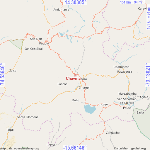
Chaviña GPS coordinates[2]
14° 58' 59.988" South, 73° 49' 59.988" West
| Map corner | latitude | longitude |
|---|---|---|
| Upper-left | -14.30305°, | -74.53646° |
| Center: | -14.98333°, | -73.83333° |
| Lower-right: | -15.66146°, | -73.13021° |
| Map W x H: | 151×151 km | = 93.8×93.8mi |
| max Lat: | -0.96667° ⇑85.3% North |
| Chaviña: | -14.98333° |
| min Lat: | ⇓14.7% South -18.01465° |
| min Long | Chaviña | max Long |
| -81.30472° | -73.83333° | -69.04167° |
| W 67.6%⇐ | ⇒32.4% E |
Elevation
Elevation of Chaviña is 3224 m = 10577 ft, and this is 905.3 m = 2970 ft above average elevation for this country.
| Max E: |
5022 m = 16476 ft | 37.1% |
| Chaviña | 3224 m 10577 ft | |
| Avg. | 2318.7 m = 7607 ft | |
Min E: |
1 m = 3 ft | 62.9% |
See also: Peru elevation on elevation.city.
Geographical zone
Chaviña is located in South Torrid zone (between Equator and Tropic of Capricorn). Distance of this Southern Tropic circle is 939.9 km =584 mi to South.| Distance of | km | miles | from Chaviña |
|---|---|---|---|
| Equator | 1666 | 1035.2 | to North |
| Tropic Capricorn | 939.9 | 584 | to South |
| Antarctic Circle | 5735.2 | 3563.7 | to South |
| South Pole | 8341.1 | 5182.9 | to South |


Nearby cities:
15 places around Chaviña: (largest is in red/bold)
• Aniso
61.4 km =38.2 mi,  71°
71°
• Chumpi
14.8 km =9.2 mi,  151°
151°
• Colta
61.2 km =38 mi,  108°
108°
• Coracora
7.7 km =4.8 mi,  135°
135°
• Incuyo
40 km =24.9 mi, 137°
• Lampa
56.6 km =35.2 mi, 113°
• Marcabamba
55.9 km =34.7 mi, 109°
• Pacapausa
50.1 km =31.1 mi,  85°
85°
• Pullo
26 km =16.2 mi,  176°
176°
• Puquio
45.1 km =28 mi,  314°
314°
• Quilcata
50.2 km =31.2 mi,  125°
125°
• San Juan
54.1 km =33.6 mi, 313°
• San Pedro
37.4 km =23.2 mi, 310°
• Tambo
22.8 km =14.2 mi,  334°
334°
• Upahuacho
47.3 km =29.4 mi,  78°
78°
Sources, notices
• [Note1] Compared only with cities in Peru existing in our database
• [Src1] Map data: © OpenStreetMap contributors (CC-BY-SA)
• [Src2] Other city data from geonames.org with taken over terms of usage.
• [Src3] Geographical zone / Annual Mean Temperature by Robert A. Rohde @ Wikipedia
